Ordinary Meeting
24 November 2021
Planning & Compliance Report
|
PLAN 05
|
Warwick Farm Racing Precinct draft
Structure Plan, draft Planning Proposal and draft Contributions Plan
|
|
Strategic
Direction
|
Strengthening
and Protecting our Environment
Exercise
planning controls to create high-quality, inclusive urban environments
|
|
File Ref
|
360071.2021
|
|
Report By
|
Cameron
Jewell - Senior Strategic Planner
|
|
Approved
By
|
David Smith
- Director Planning & Compliance
|
At
its meeting of 29 September 2021, Council resolved (PLAN 06) to re-exhibit the
revised draft Warwick Farm Racing Precinct structure plan, draft planning
proposal and draft contributions plan (the planning package) for a period of 28
days, and to receive a further report following public exhibition. This follows
changes made to the draft planning package based on a previous round of
community consultation in late 2020.
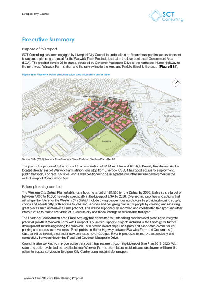
This report provides a summary of submissions received
during the public exhibition period and outlines the next steps for
Council’s consideration.
Council received 26 submissions during the public
exhibition period, including 15 submissions in opposition and 11 who were
supportive of rezoning the precinct in principle, however concerns were raised
with several elements of the planning package.
Recent changes in the Department of Planning, Industry
and Environment’s (DPIE) planning proposal assessment processes mean that
more information is now being required prior to planning proposals being lodged
with DPIE seeking a Gateway determination. Specifically, planning proposals
within the Liverpool Collaboration Area and Moorebank East have been returned
from Gateway assessment, with DPIE stating that planning proposals should only
be resubmitted “once the findings of Council’s Regional Flood
Evacuation Study can inform the proposal”.
Council’s consultant is finalising this study,
with a draft discussion paper due at the end of November 2021 to enable further
detailed discussions with SES, DPIE and the Planning Delivery Unit (PDU).
Council will continue to progress the finalisation of this study, with the
assistance of the PDU and DPIE to enable planning proposals in these areas to
be considered for a Gateway determination by DPIE.
Noting
the above, it is recommended that Council supports in principle the revised planning
package as exhibited, and upon finalisation of the Regional Flood Evacuation Study, delegates authority to the CEO to make any minor amendments to
the planning package as may be required and forwards the planning proposal to
the DPIE seeking a Gateway determination.
That Council:
1. Notes the submissions received on the revised draft planning
package;
2. Notes that the Department of Planning, Industry
and Environment requires the final planning proposal to be informed by the
Regional Flood Evacuation Study, prior to Council forwarding the planning
proposal to DPIE for a Gateway determination;
3. Supports in principle the revised planning
package as exhibited;
4. Delegates authority to the CEO to make minor
amendments to the planning package following the finalisation of the Regional
Flood Evacuation Study;
5. Delegates authority to the CEO to forward the
planning proposal to the Department of Planning, Industry and Environment,
pursuant to Section 3.34 of the Environmental Planning and Assessment Act 1979,
seeking a Gateway determination;
6. Subject to Gateway determination, undertake public exhibition and
community consultation on the planning proposal in accordance with the
conditions of the Gateway determination and Council’s Community
Participation Plan; and
7. Receives a further report on the outcomes of public exhibition and
community consultation.
Background
At
its meeting on 28 April 2021, Council resolved (EGROW 04) to appoint a
consultant to refine the draft Warwick Farm Racing Precinct Structure Plan,
draft planning proposal and draft contributions plan (the planning package),
and to receive a further
report on the revised planning package following refinement of the plans.
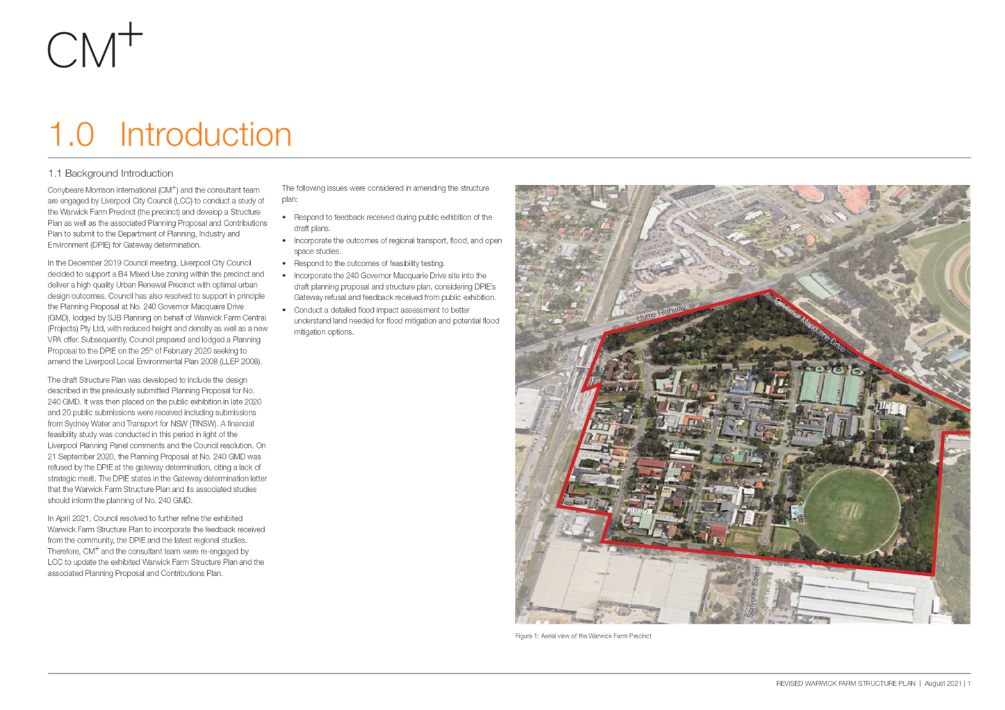
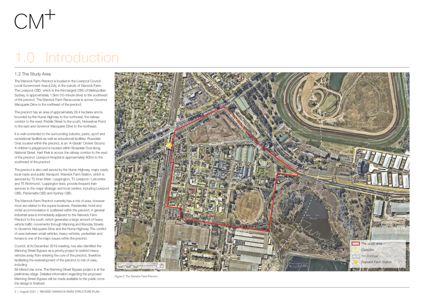
Conybeare
Morrison International was reappointed to:
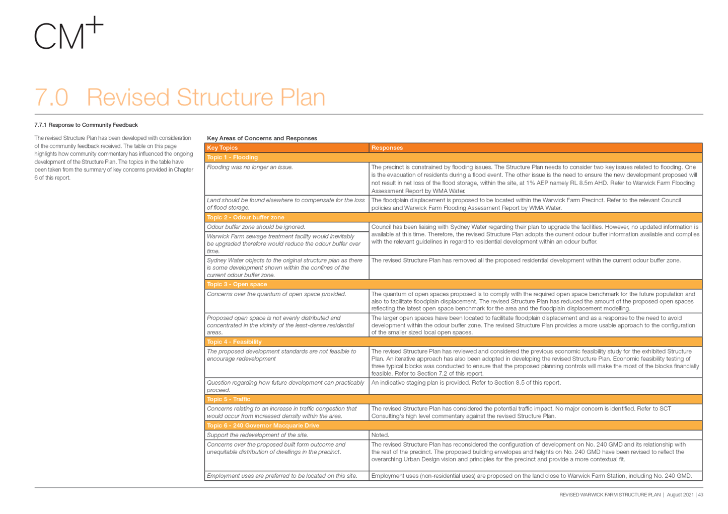
· Respond to feedback received
during public exhibition of the draft plans;
· Incorporate the outcomes of
regional transport, flood, and open space studies;
· Respond to the outcomes of
feasibility testing;
· Incorporate the 240 Governor
Macquarie Drive site into the draft planning proposal and structure plan,
considering DPIEs Gateway refusal and feedback received from public exhibition;
and
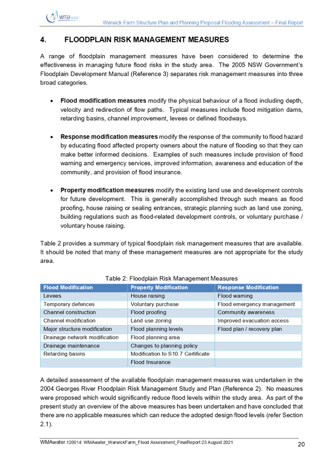
· Conduct a detailed flood impact
assessment to better understand land needed for flood mitigation and potential
flood mitigation options.
At its meeting on 29 September 2021 (PLAN
06), Council considered the revised draft planning package and resolved to place the revised plans on public
exhibition for a further 28 days and receive a report for a decision on whether
to forward the planning proposal to DPIE for a Gateway determination.
This report details the submissions
received during the consultation period.
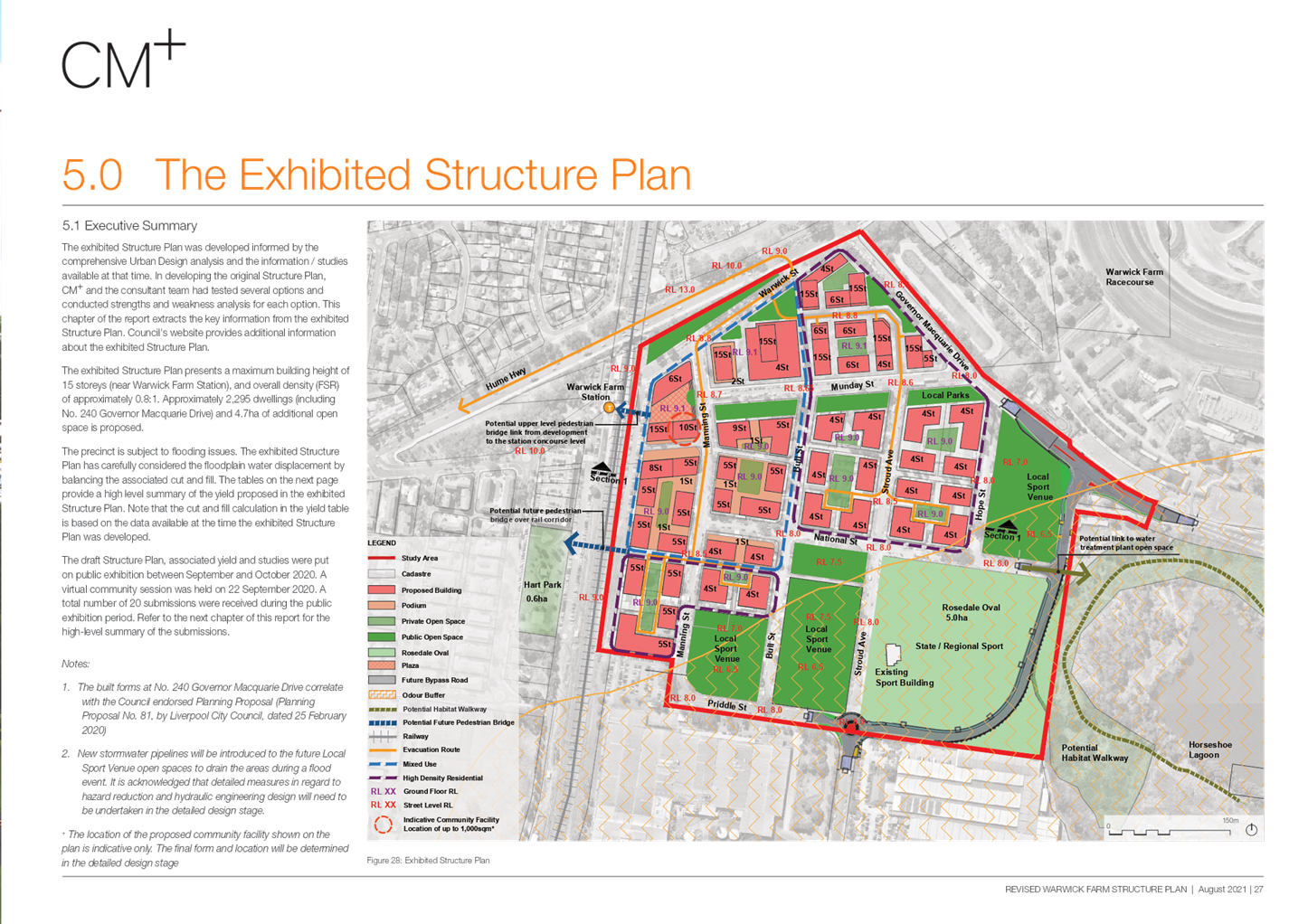
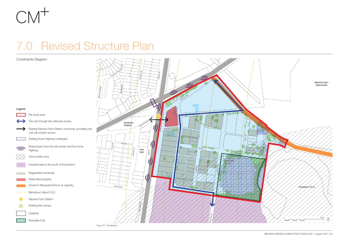
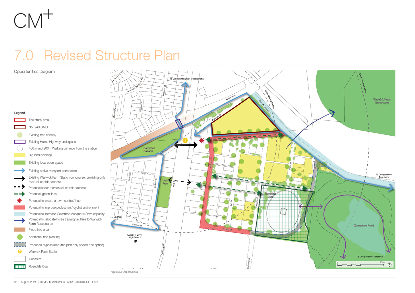
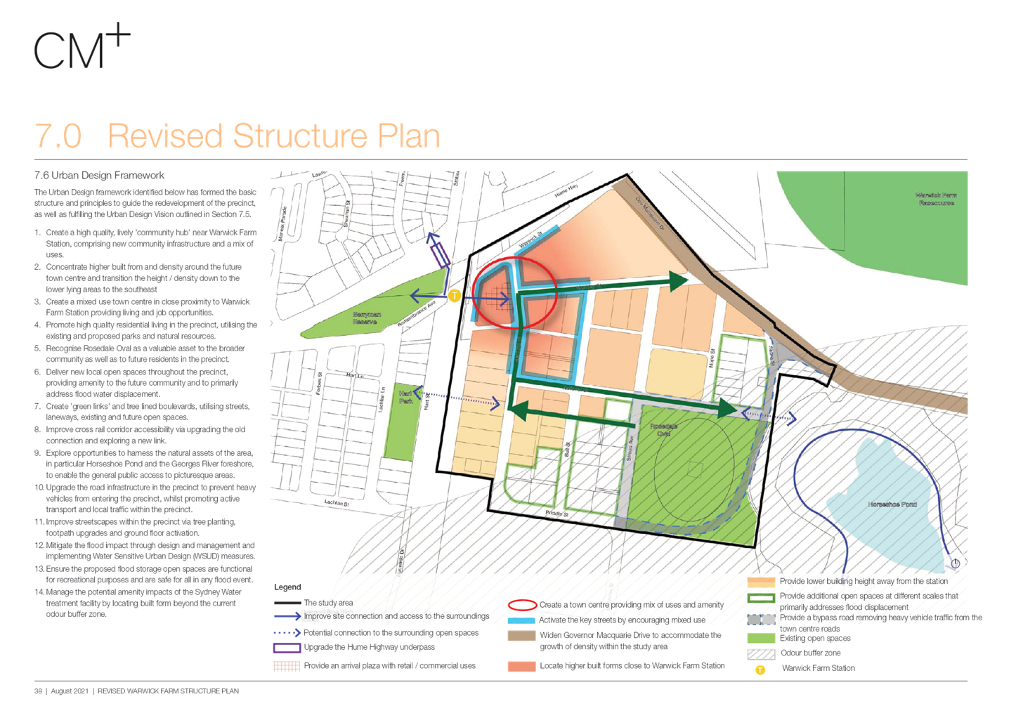
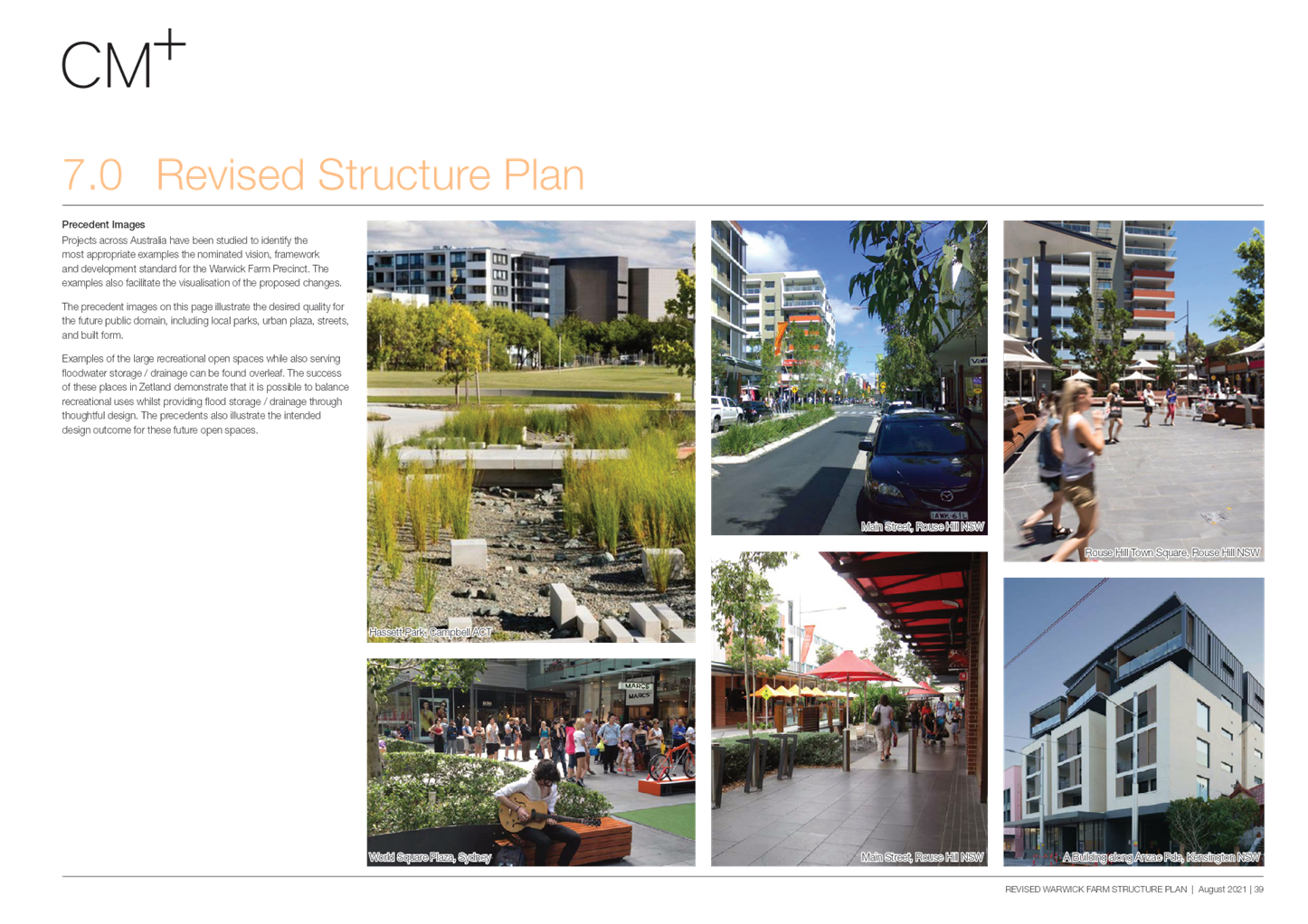
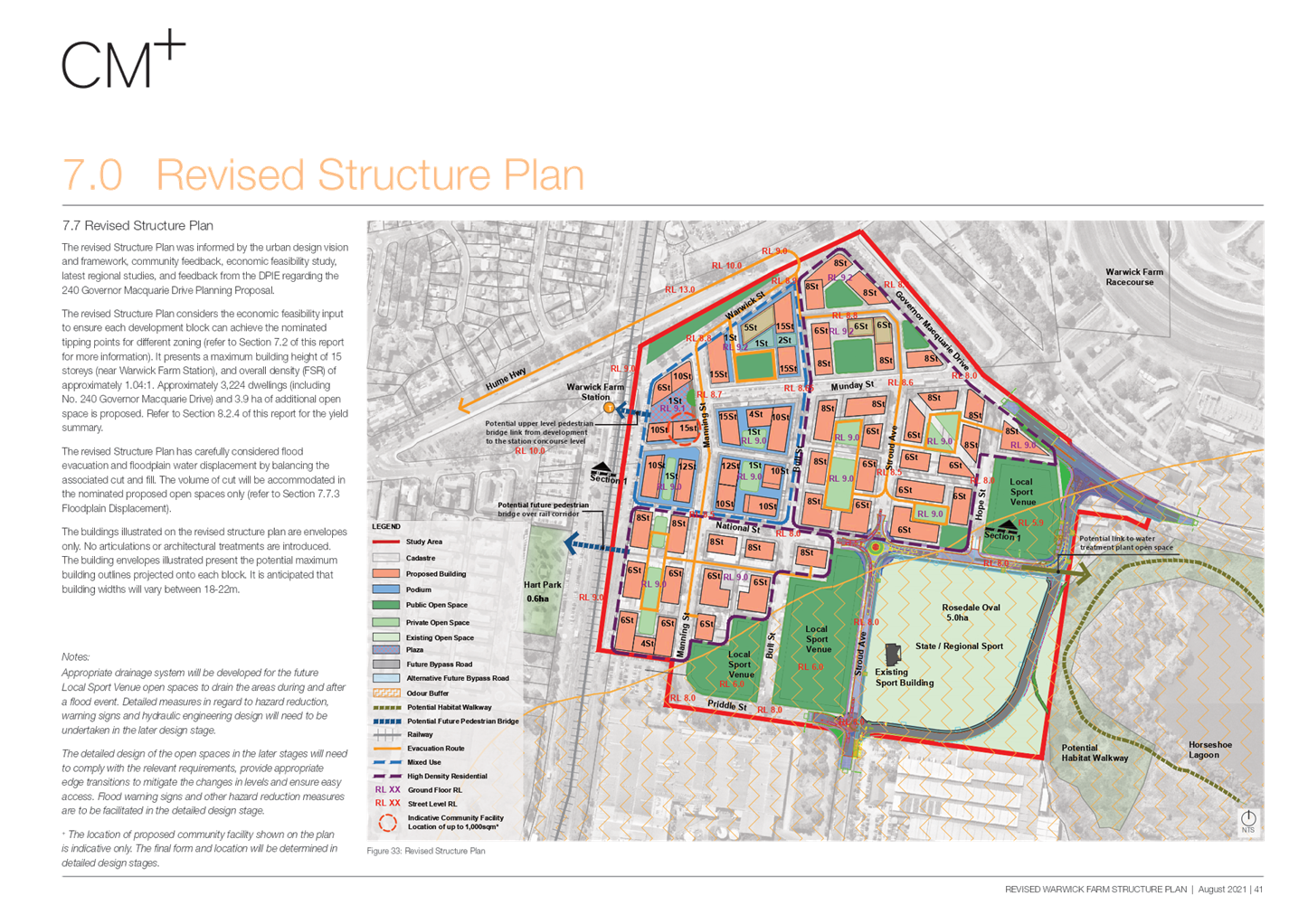
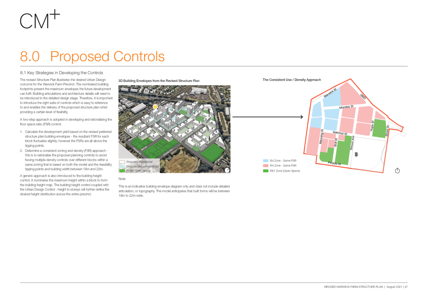
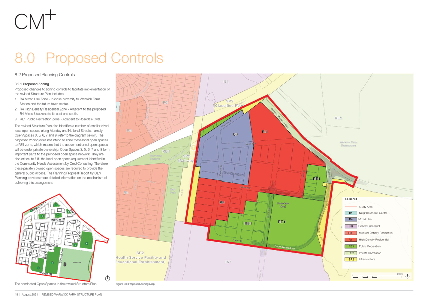
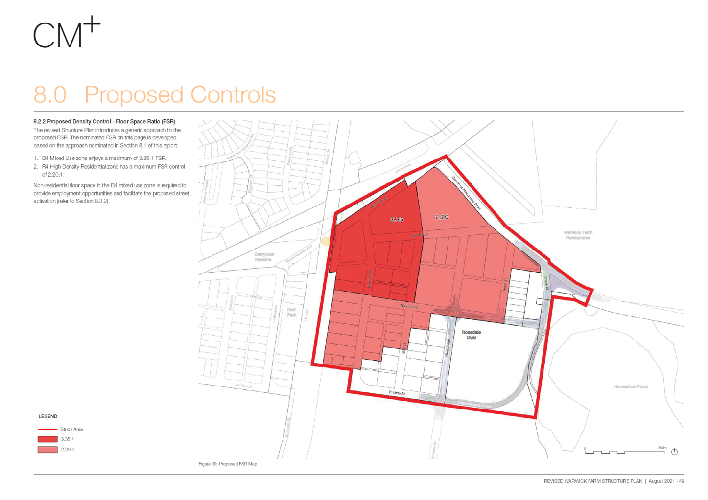
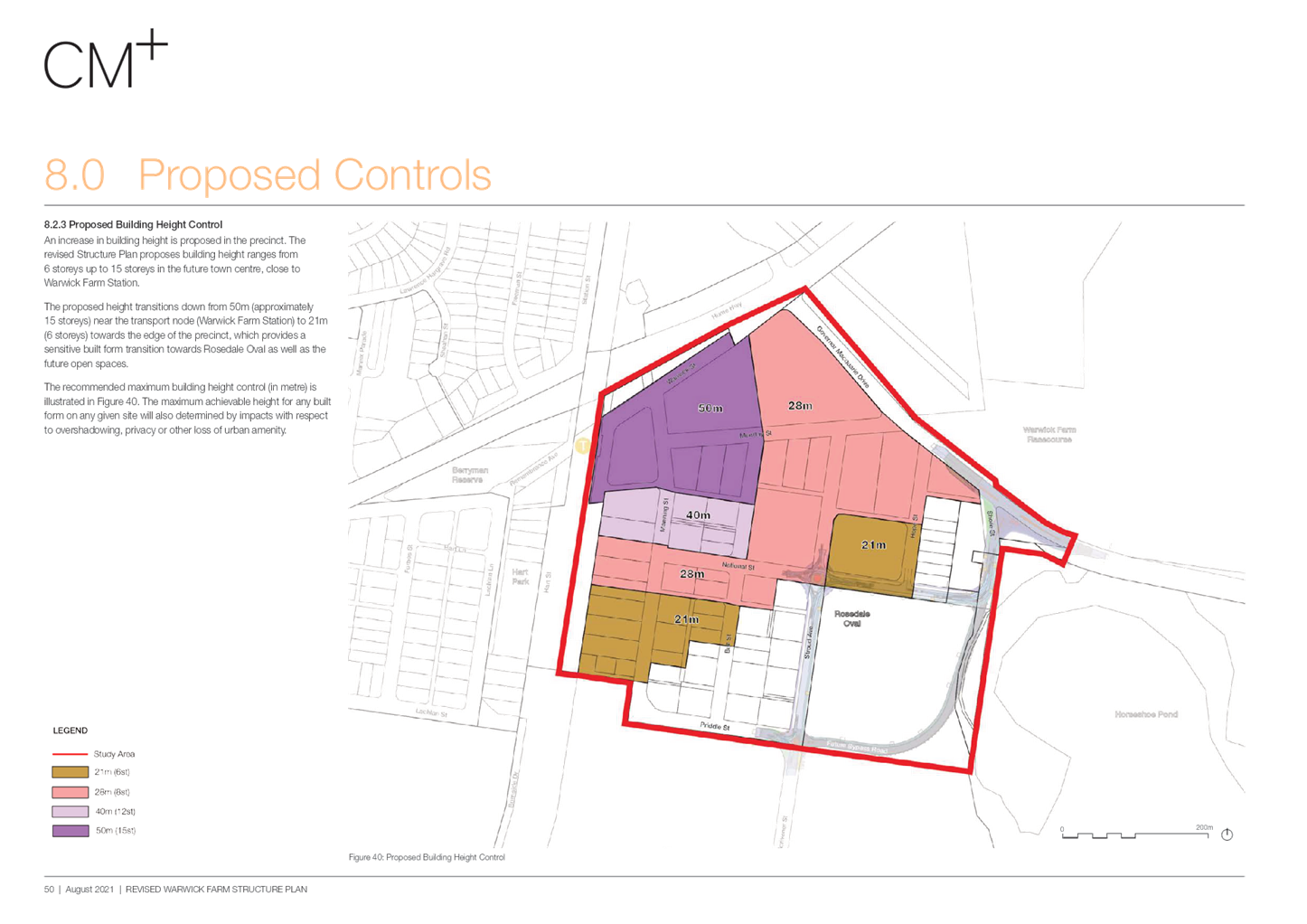
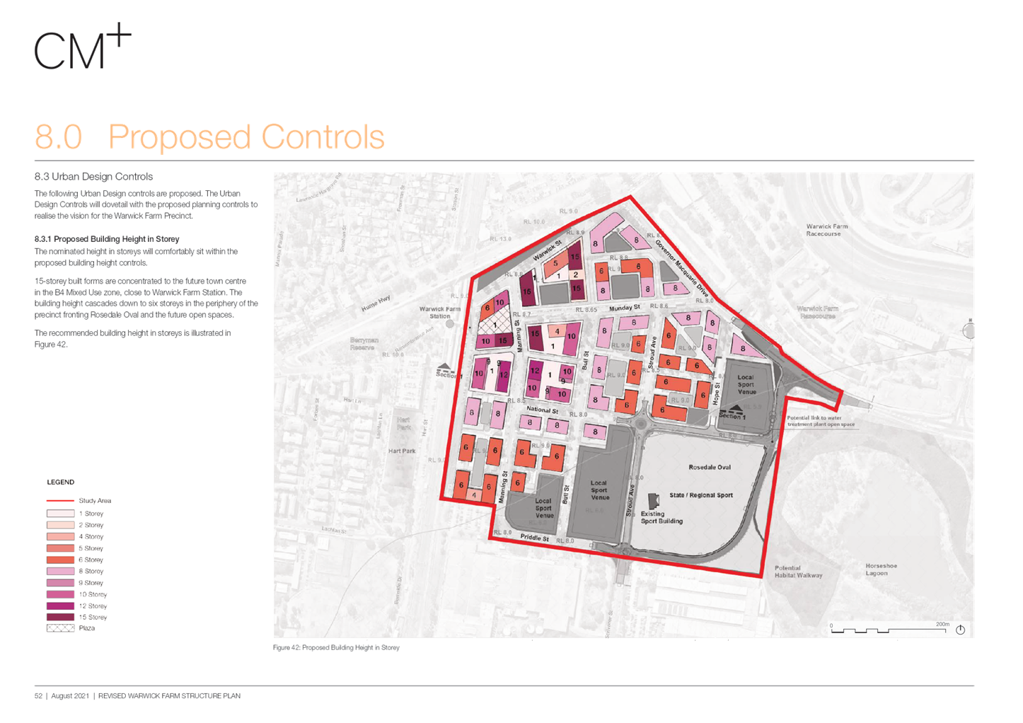
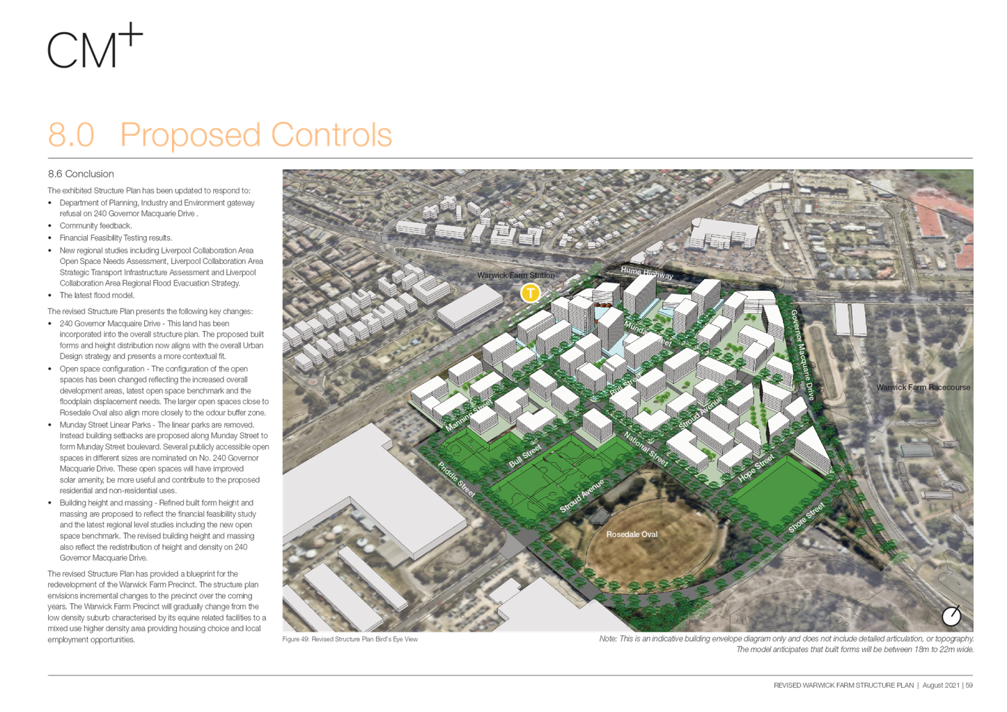
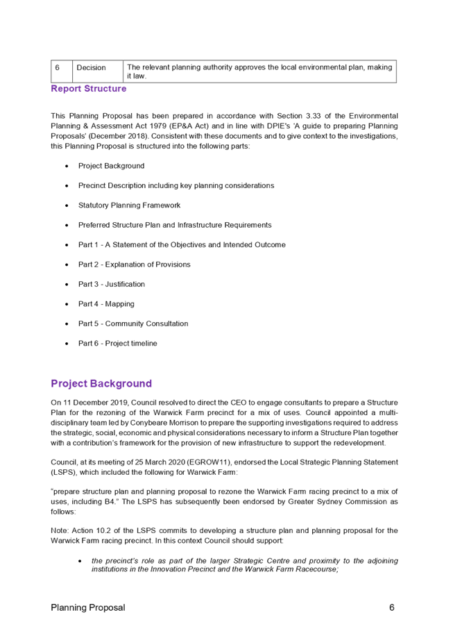
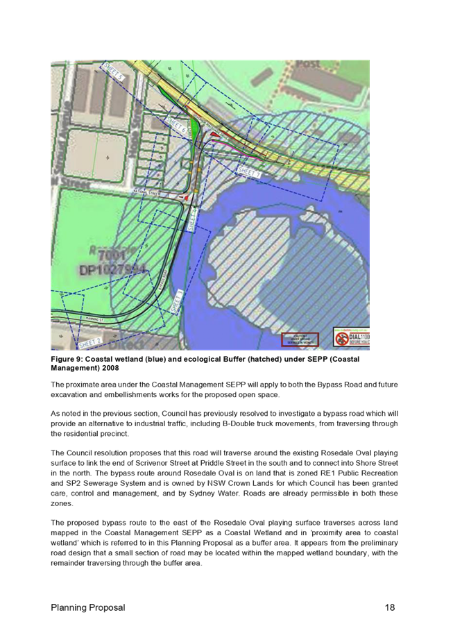
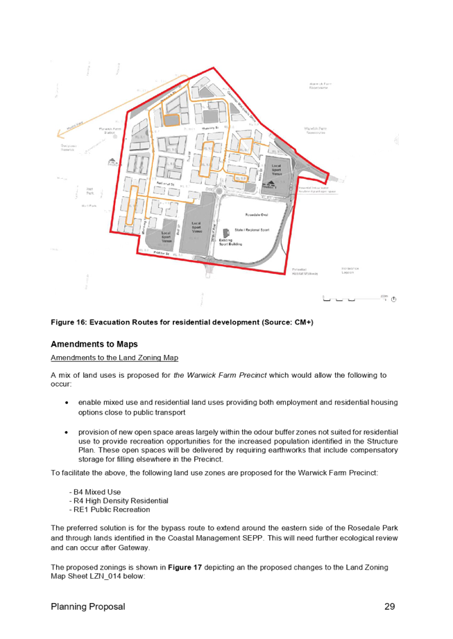
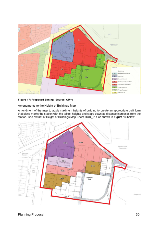
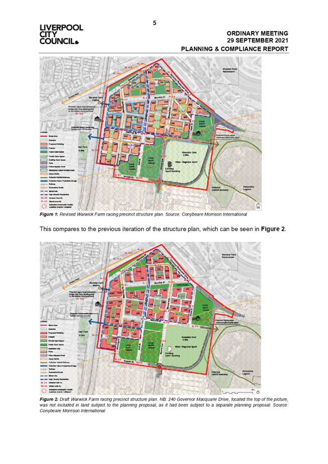
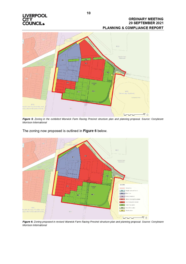
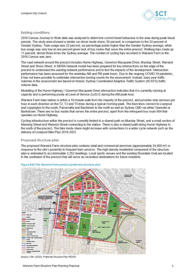
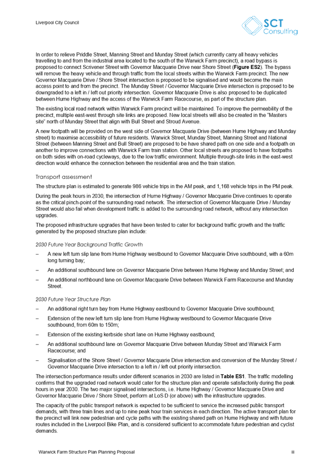
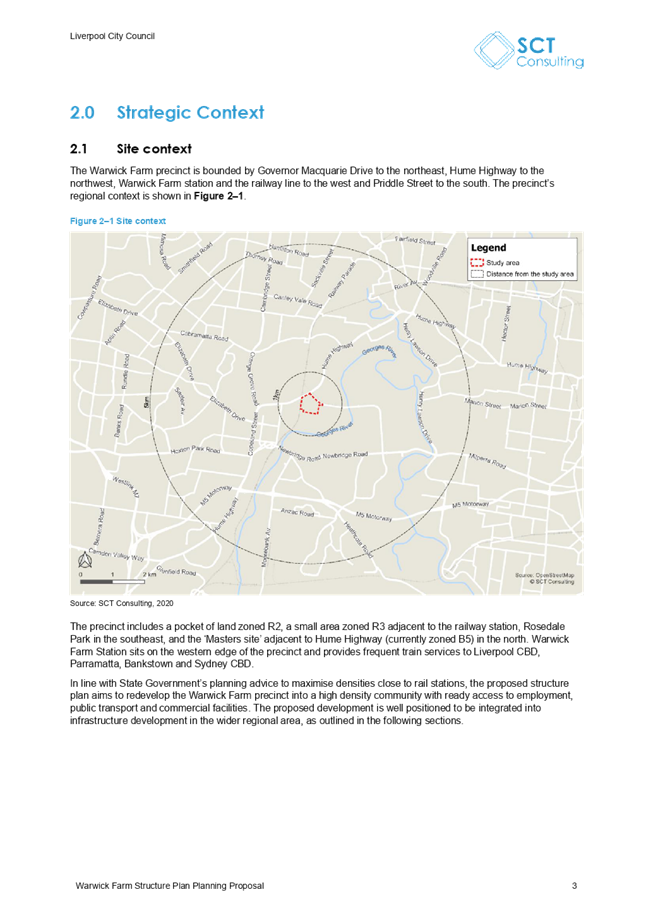
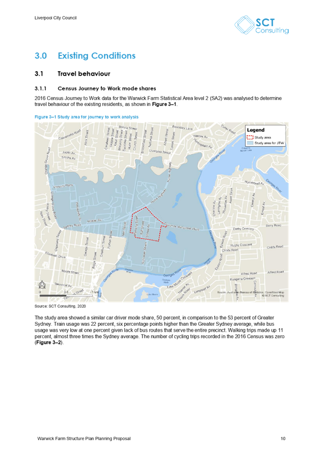
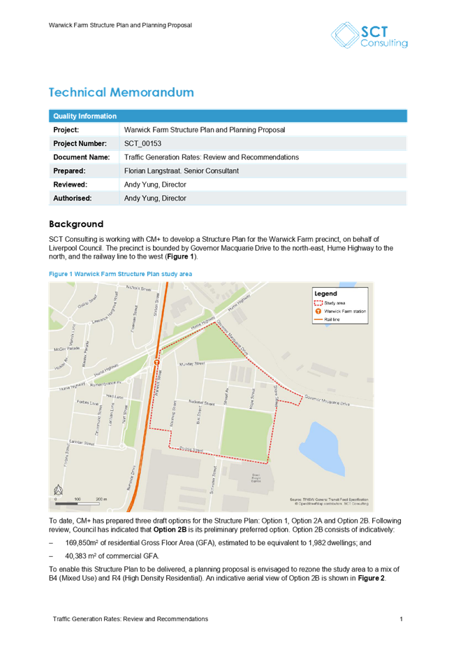
Public Exhibition
The draft planning package was placed on public
exhibition from 8 October 2021 to 7 November 2021. The draft structure plan is
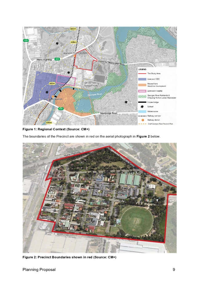
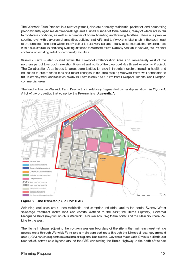
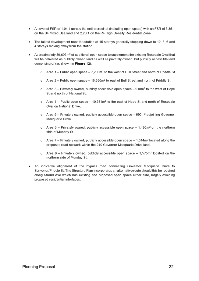
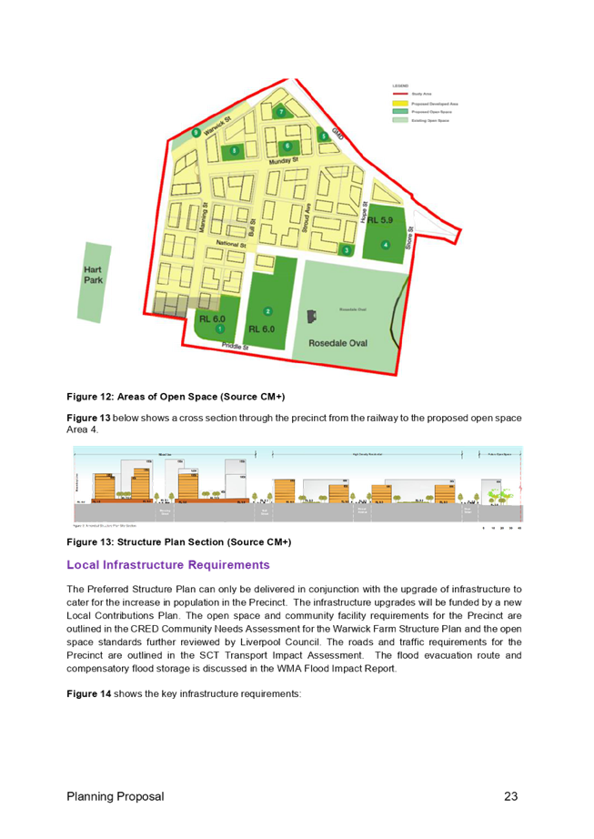
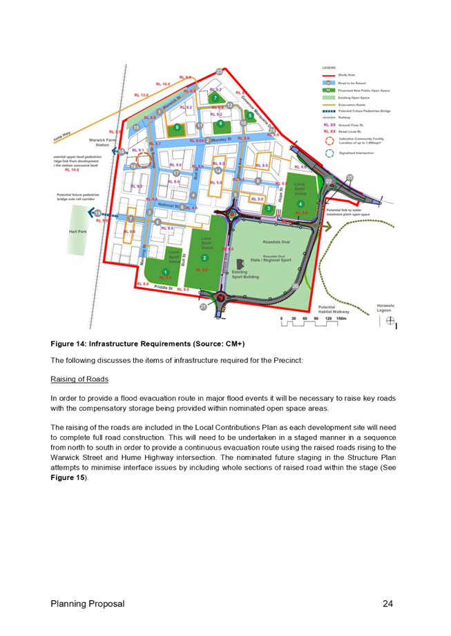
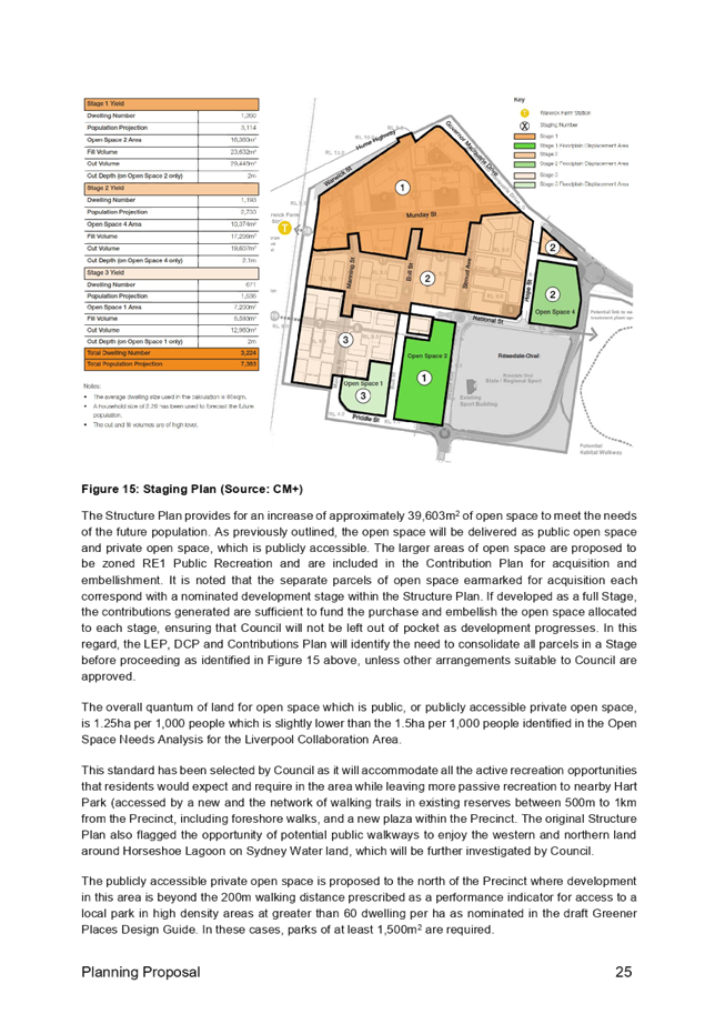
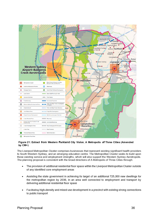
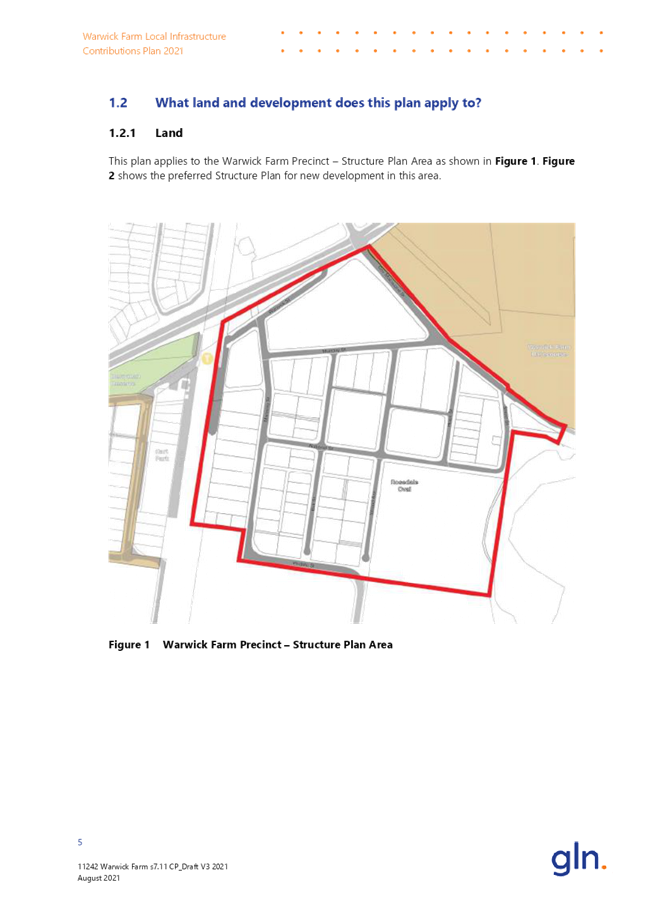
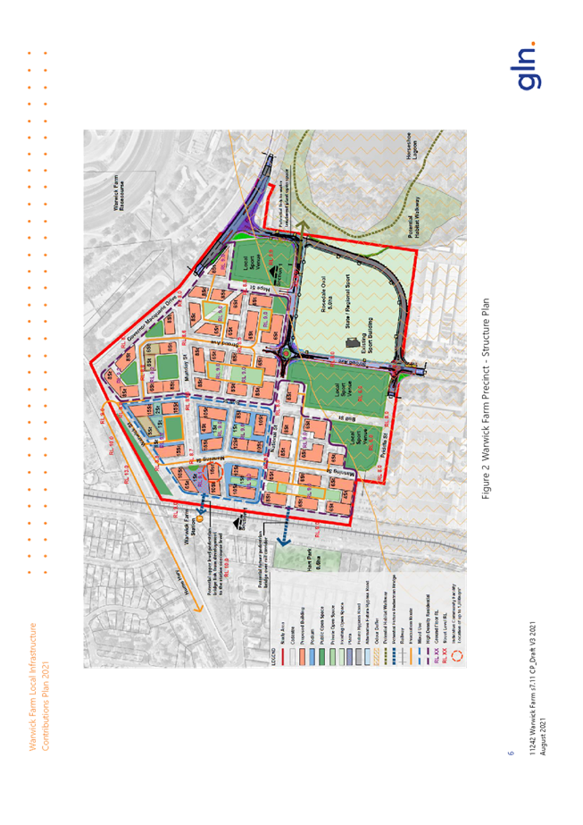
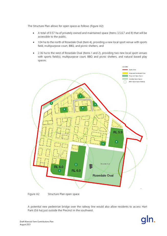
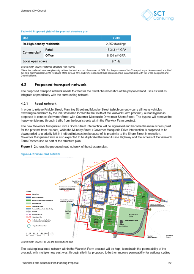
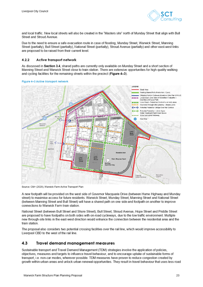
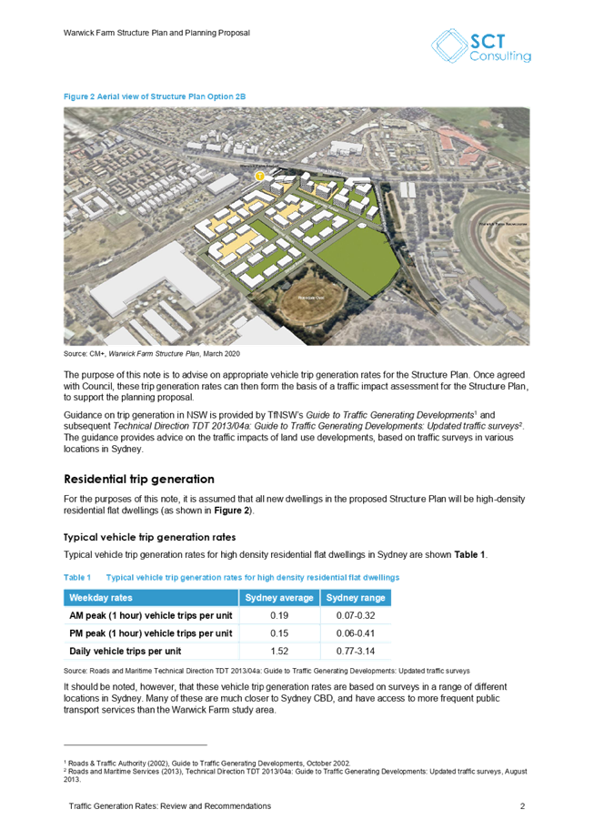
outlined in Figure 1 below.
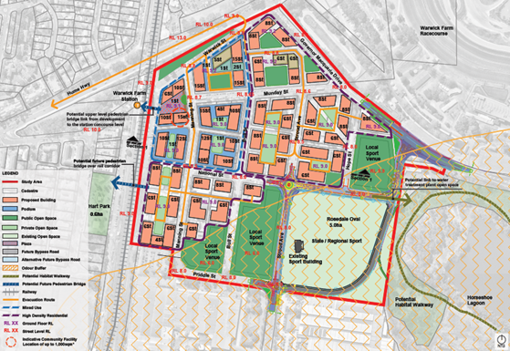
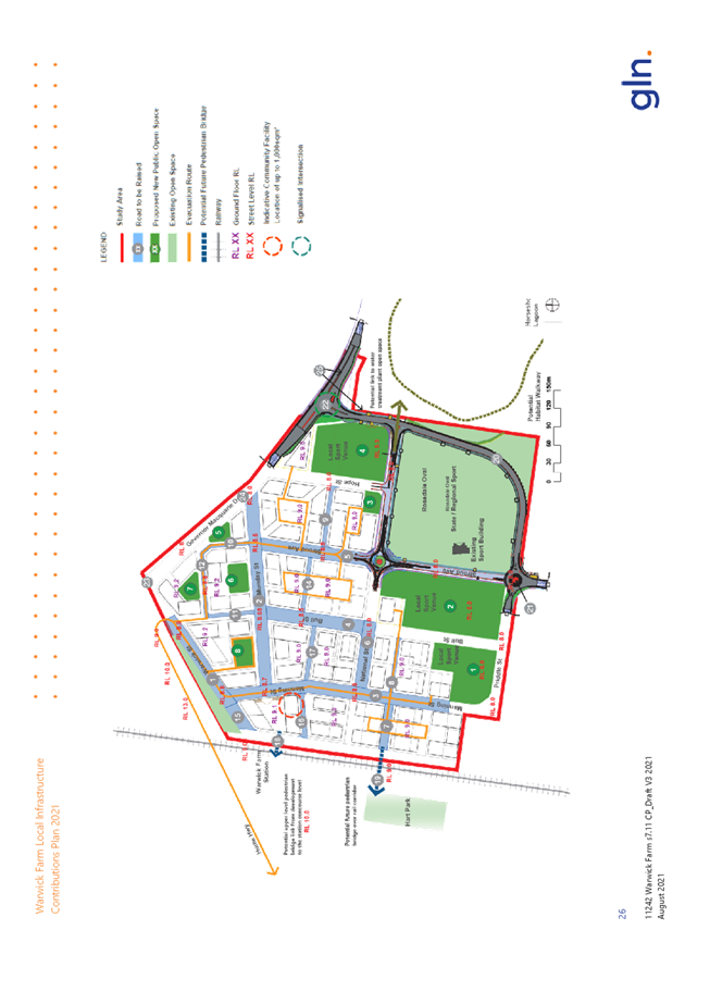
Figure 1 - Draft revised
Warwick Farm structure Plan (Source: CM+)
The planning package was exhibited on Council’s
website and included the following documentation:
· draft structure plan (Attachment 4);
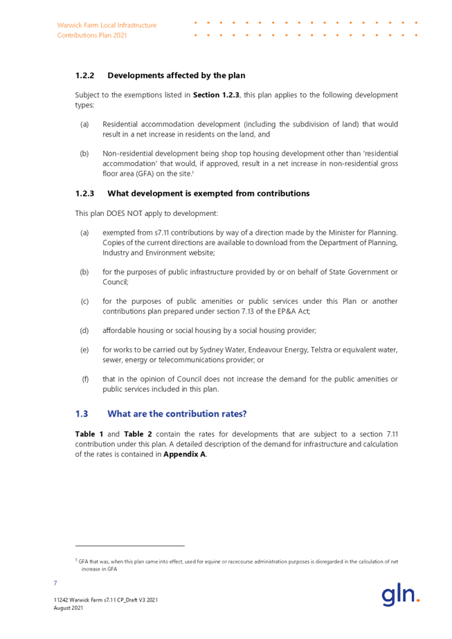
· draft planning proposal (Attachment 5);
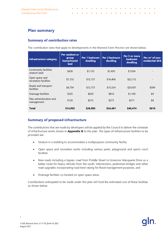
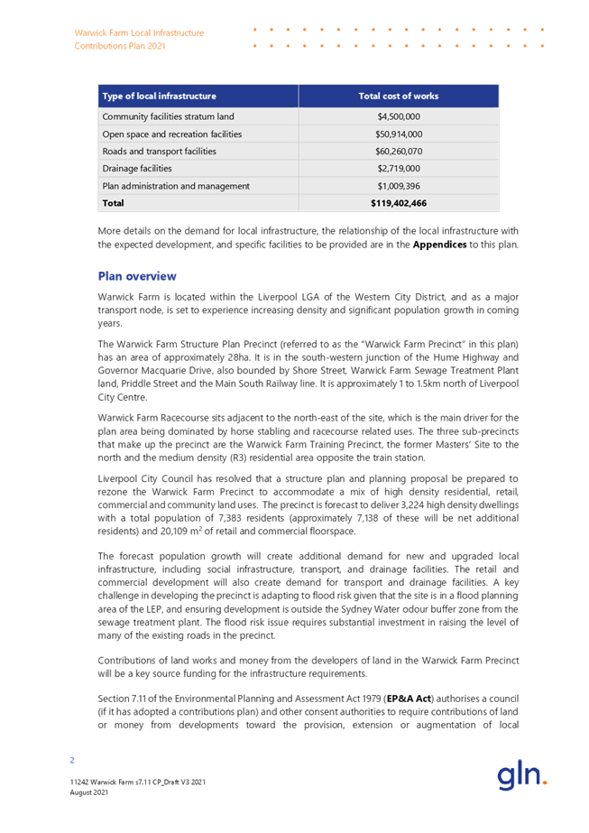
· draft contributions plan (Attachment 6);
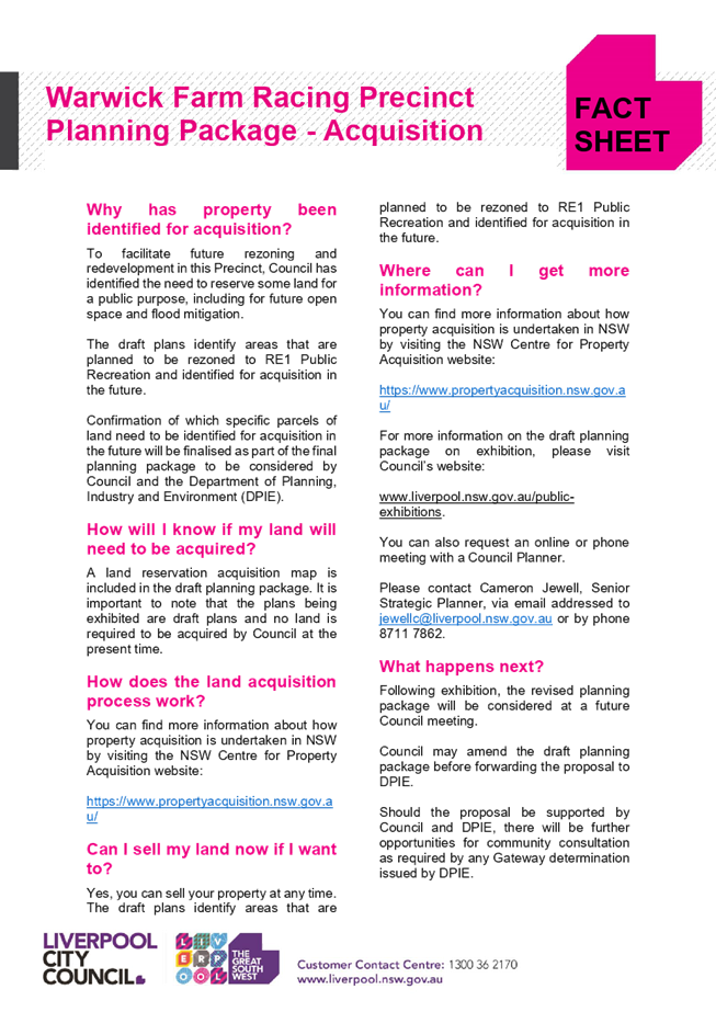
· a summary fact sheet (Attachment 7);
· Council report and resolution (Attachment
8);
· flood assessment report (Attachment 9);
· economic feasibility testing (Attachment
10);
· traffic impact assessment (Attachment 11);
and
· a fact sheet on property acquisition
(Attachment 12).
Letters were also sent to landowners in the precinct,
and a Facebook and LinkedIn post was published. Council also offered one-on-one
meetings during the exhibition period to any interested landowners, however
there were no requests made.
Summary of submissions
Council received 26 submissions during the public
exhibition period. Of the 26 submissions received, 15 submissions were opposed
to the plans and 11 were supportive of rezoning the precinct in principle,
however some raised issues with several elements of the planning package and
requested changes.
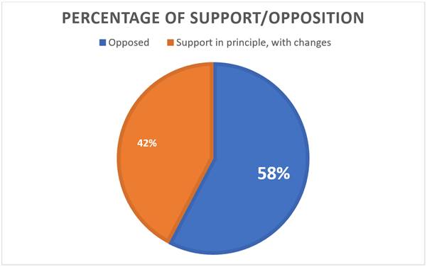
Figure 2 - Percentage of
support/opposition in submissions received during the public exhibition period
Of the 15 submissions opposed:
· nine were from people living outside the
precinct;
· four were from landowners within the area;
and
· two did not provide address information.
The four submissions opposing the plans with address
details were from landowners whose properties are proposed to be zoned RE1
Public Open Space and acquired by Council in the future.
Of the 11 submissions that were supportive of the
rezoning in principle, all but one owned land within the precinct that was
proposed to be zoned either B4 Mixed Use or R4 High Density Residential. All 11
raised issues with the plans as proposed, including requests for additional
height and FSR, changes to precinct boundaries, issues with the proposed
staging and sequencing plan, concerns related to feasibility and the cost of
contributions, and disagreement with the flood impact assessment and the
necessity of raising roads.
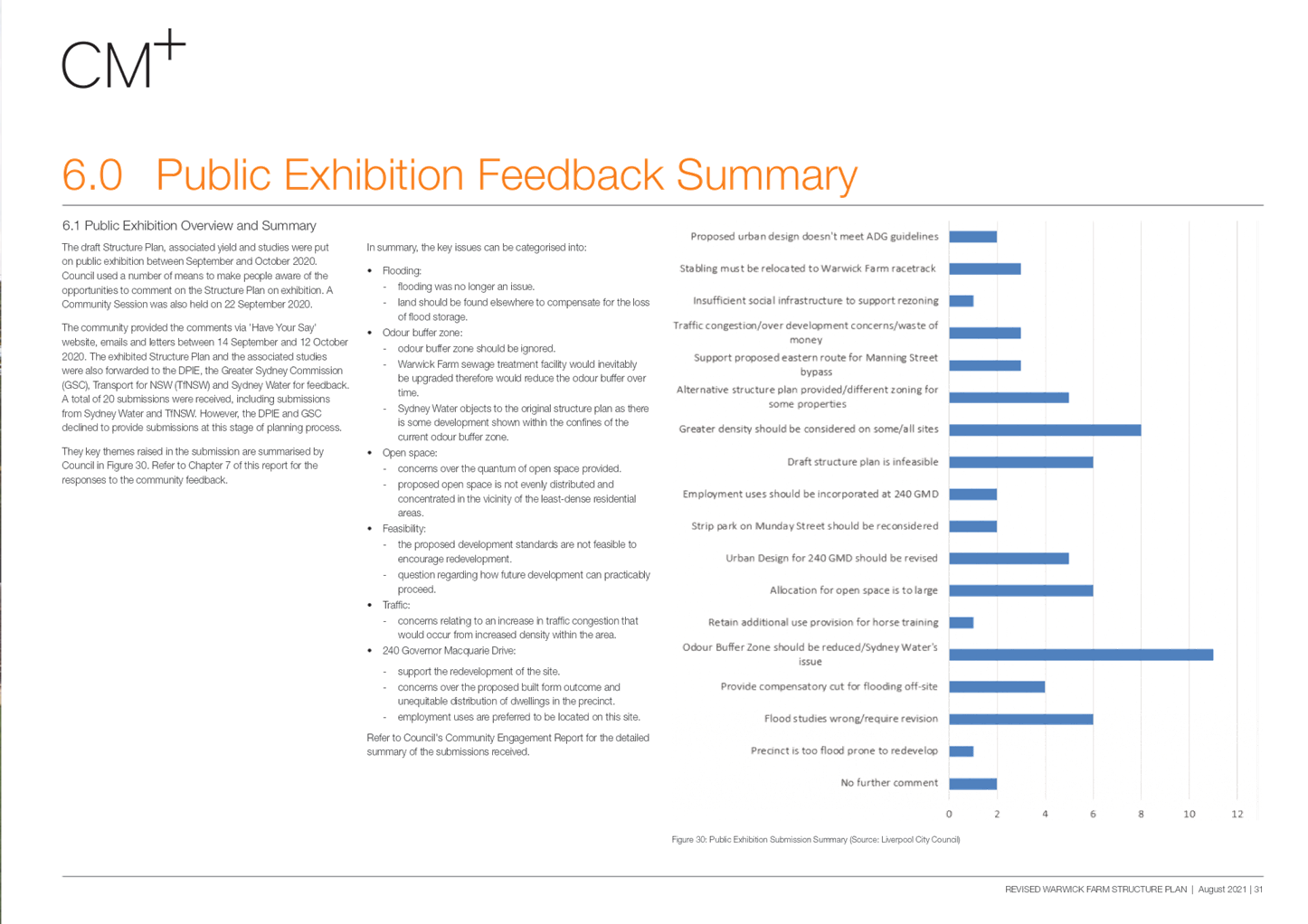
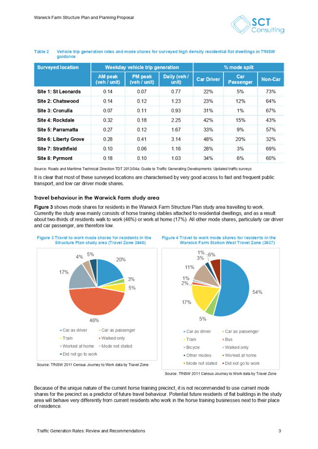
Figure 3 illustrates the key themes (raised more than once) in the submissions
received and how many times each category was mentioned. This figure helps to
demonstrate the strength of sentiment regarding specific issues.
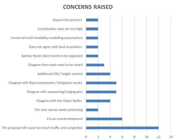
Figure 3 - Key themes
raised during public exhibition
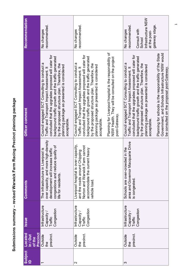
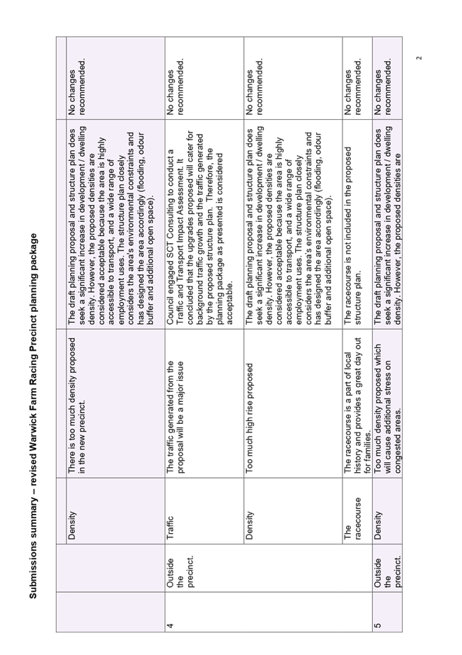
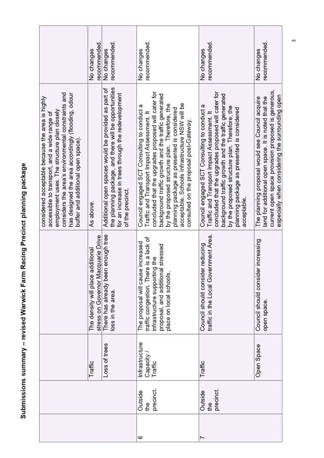
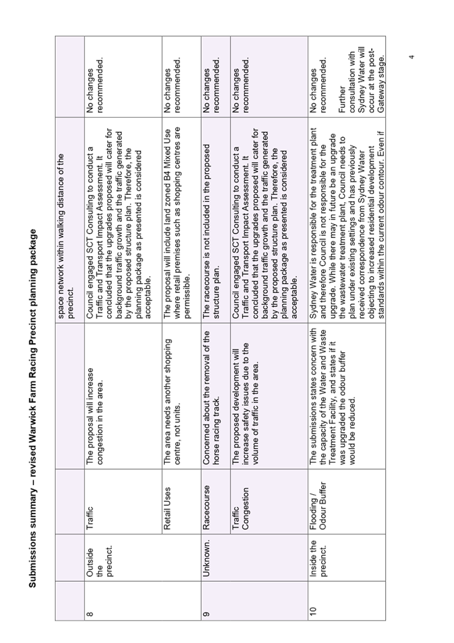
A detailed summary of each submission is provided in
Attachment 1 and 2, however key issues raised during public exhibition are
summarised below.
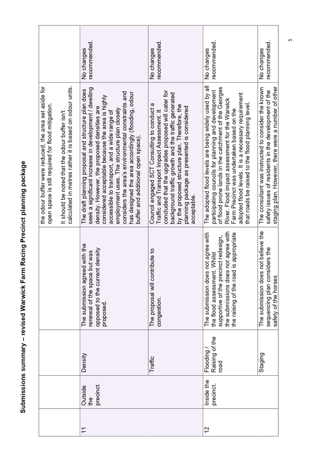
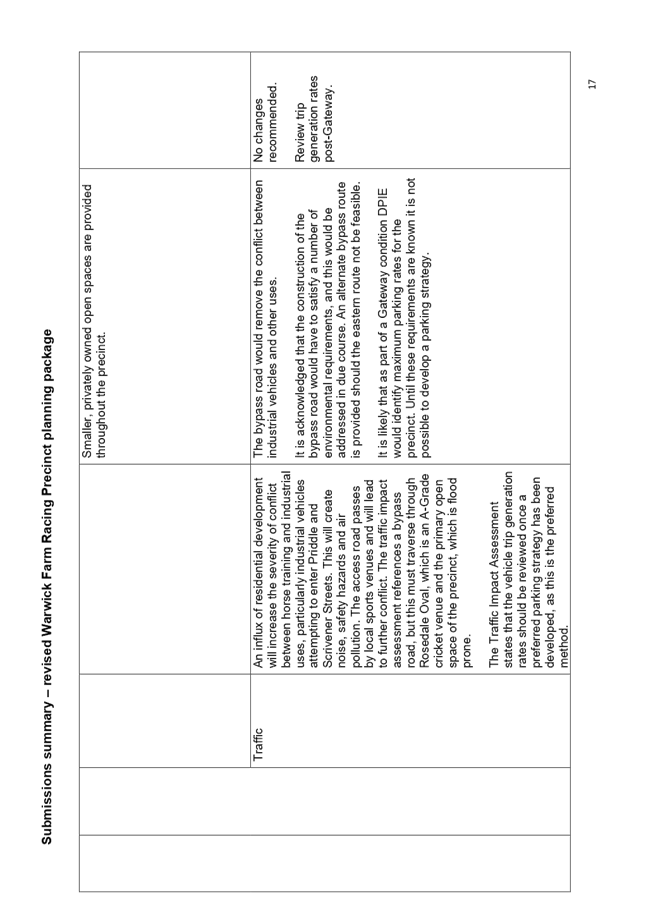
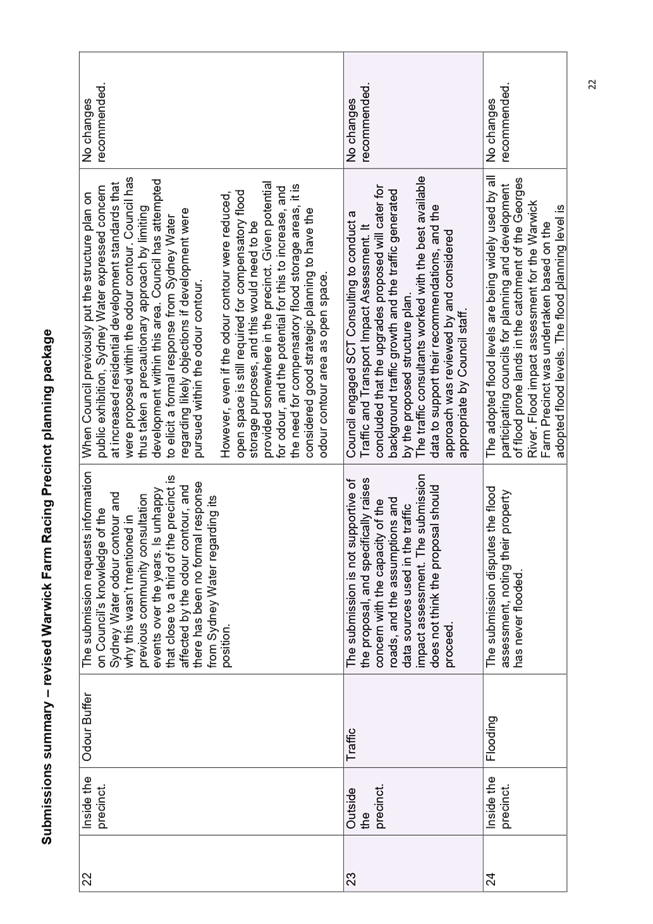
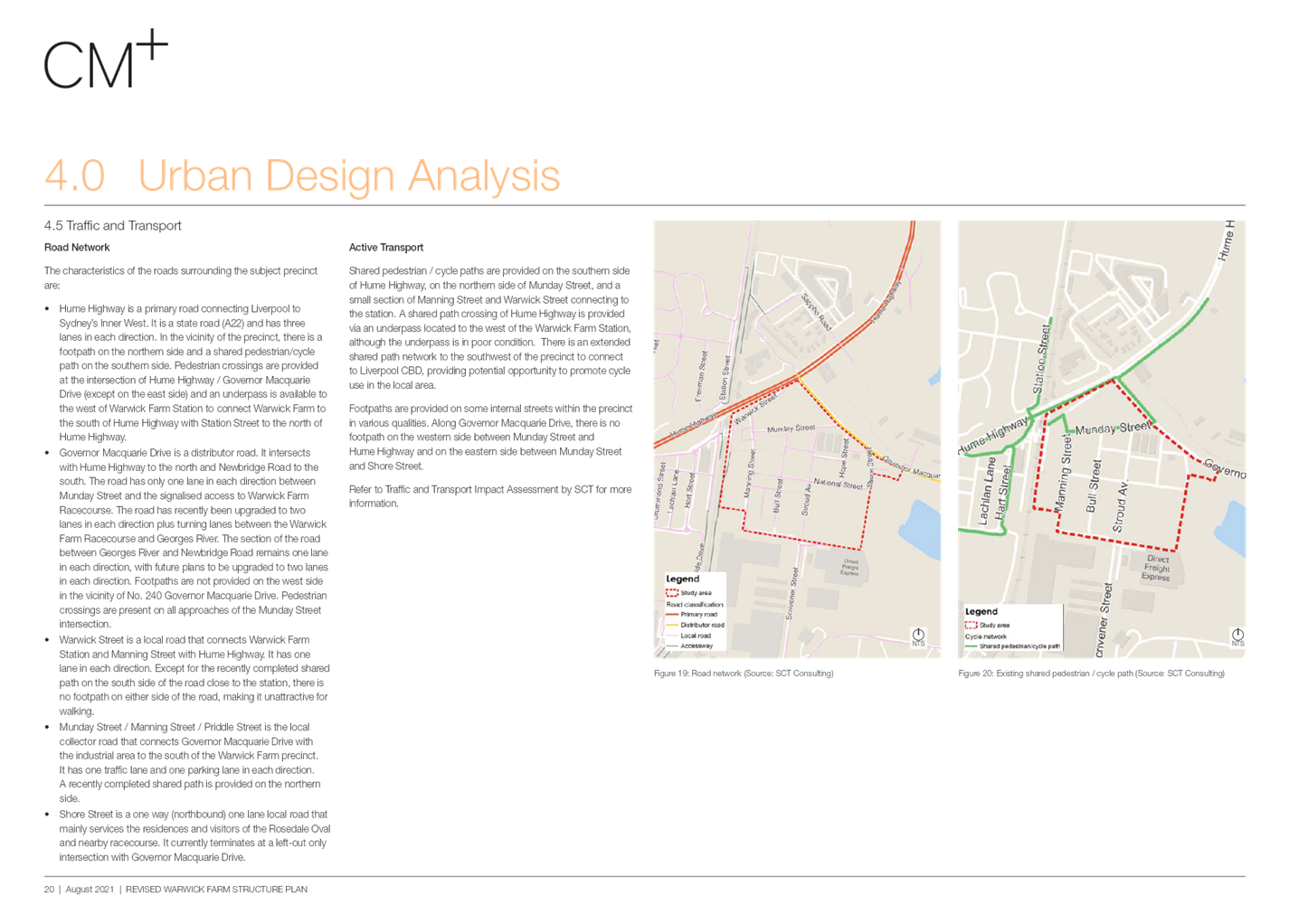
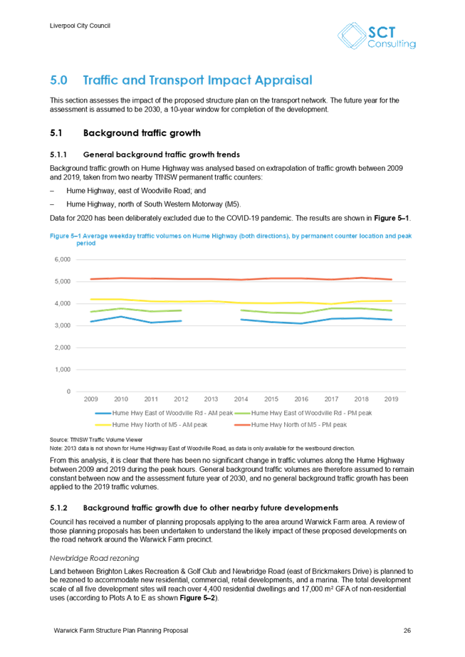
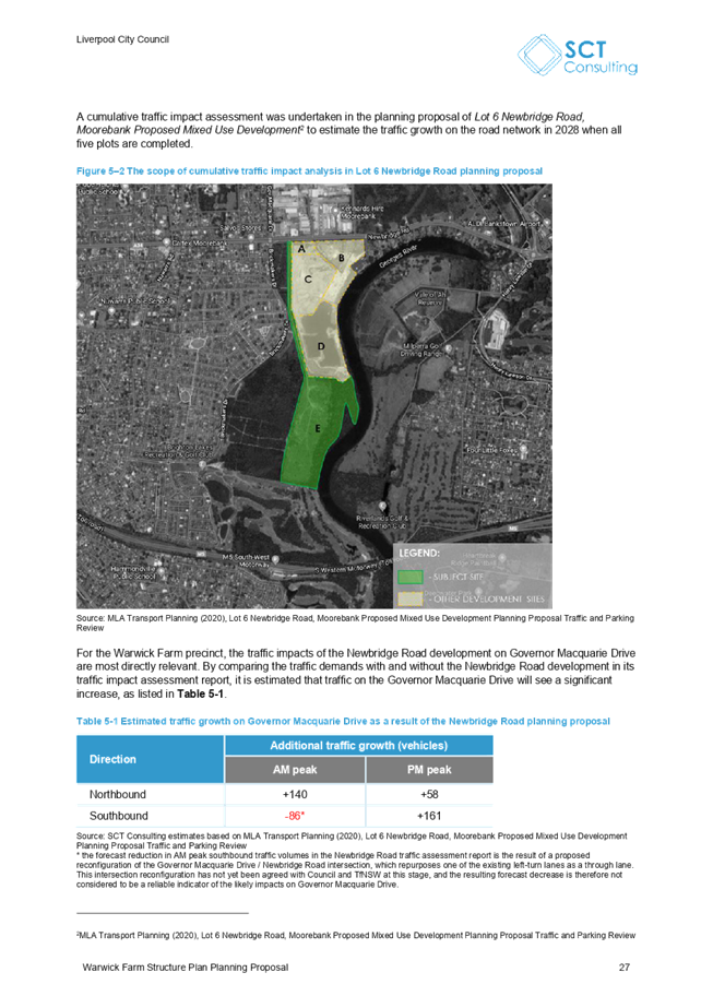
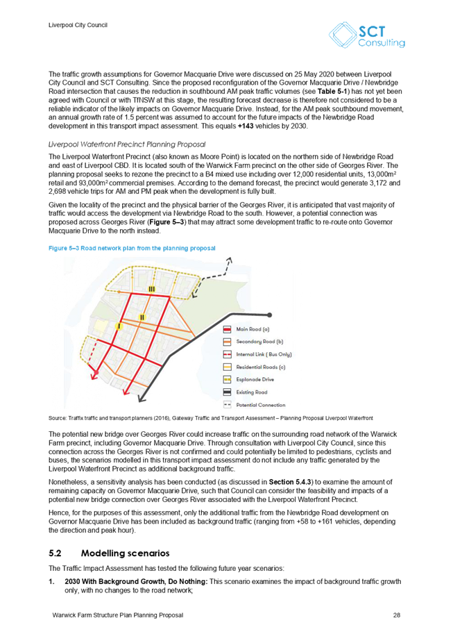
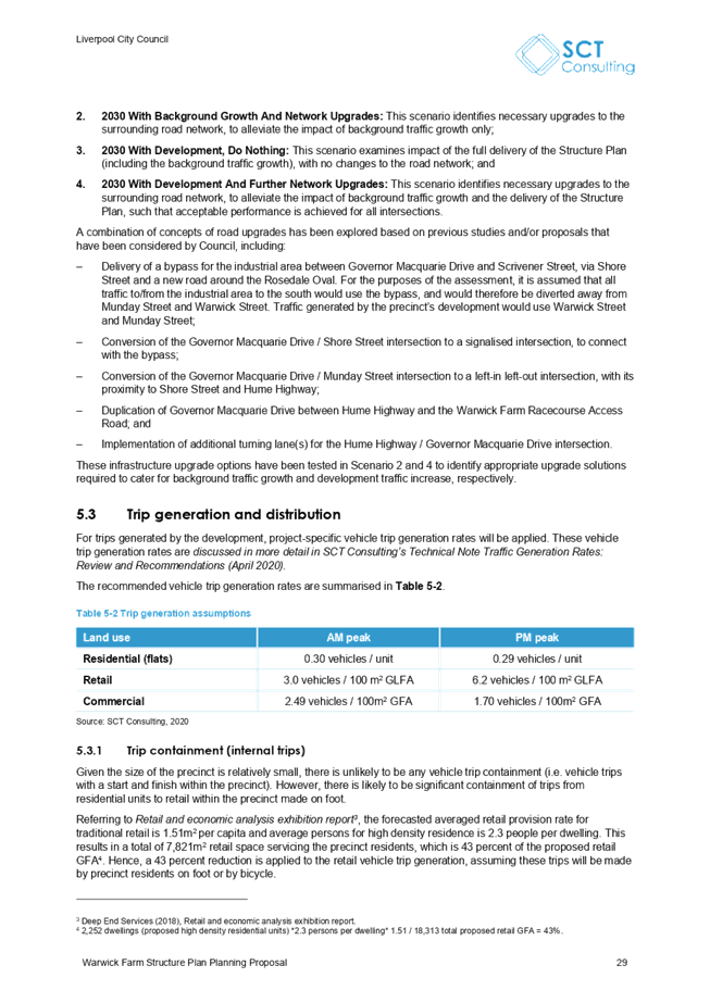
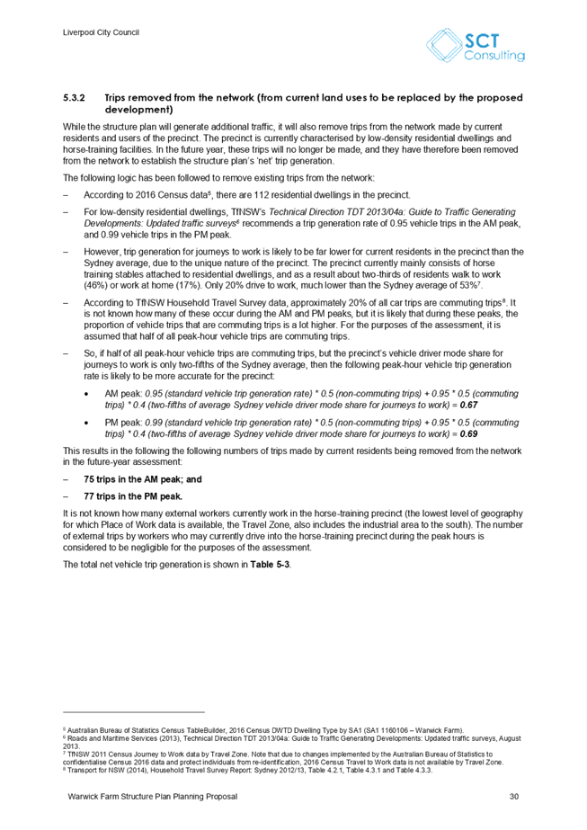
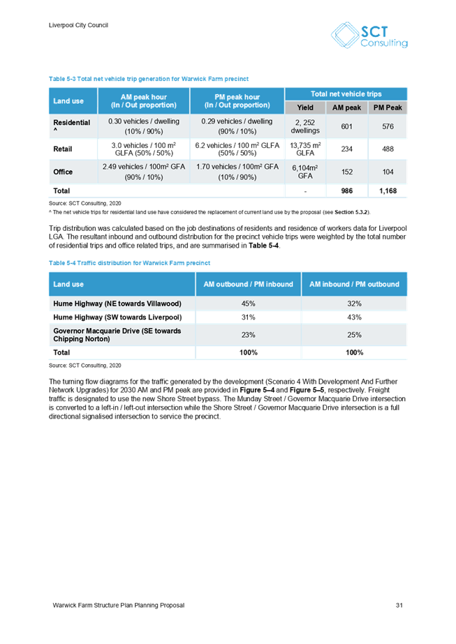
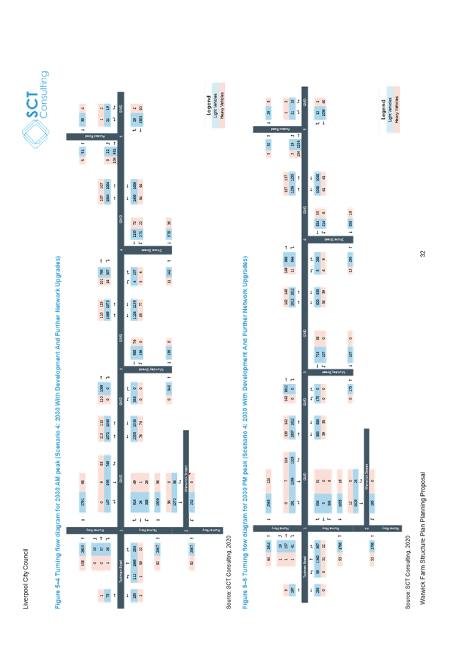
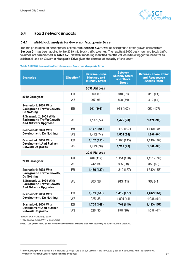
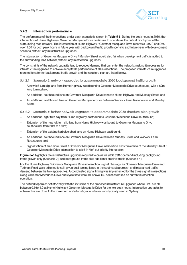
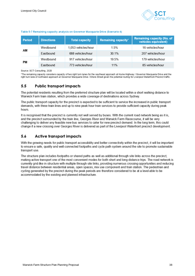
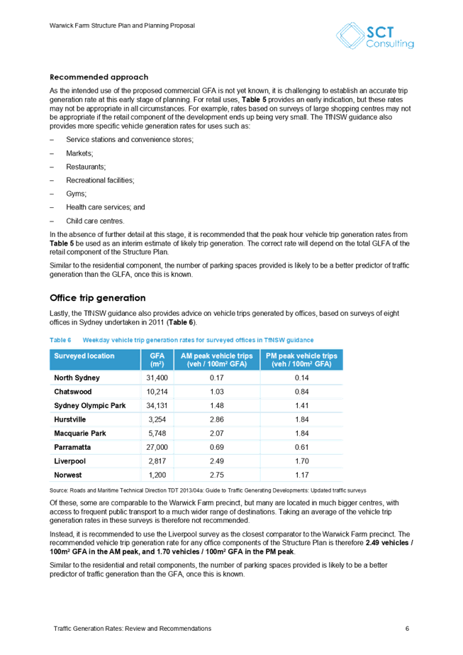
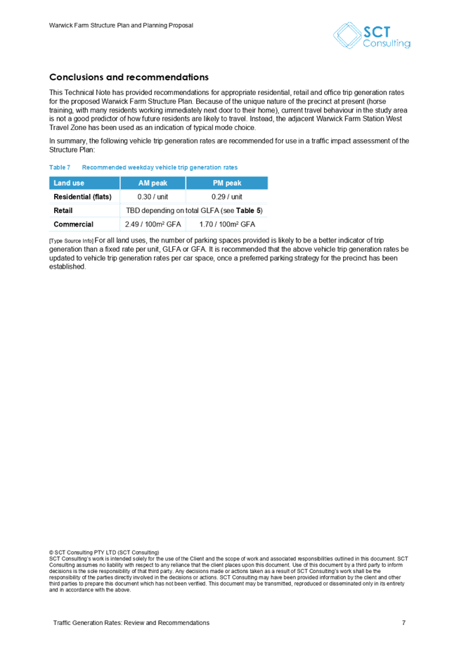
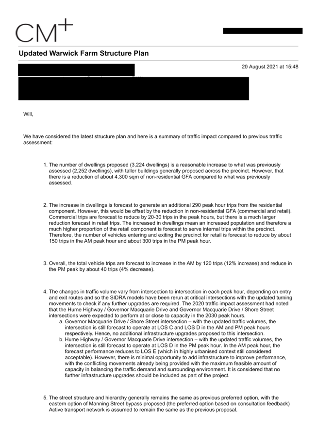
Traffic
Many
submissions, mostly from people outside the precinct, expressed concern about
increased traffic congestion that would likely result from rezoning this
precinct to allow high density residential and mixed uses. The rezoning
proposal is supported by a Traffic Impact Assessment and road upgrades are
proposed to support future development, funded by the proposed Local
Infrastructure Contributions Plan. The traffic impact assessment indicates that
the rezoning can be supported, subject to the proposed road upgrades.
Perceived
overdevelopment
Many
submissions, mostly from people outside the precinct, indicated that the
proposal represented an overdevelopment and that there were too many high-rise
developments in Liverpool already.
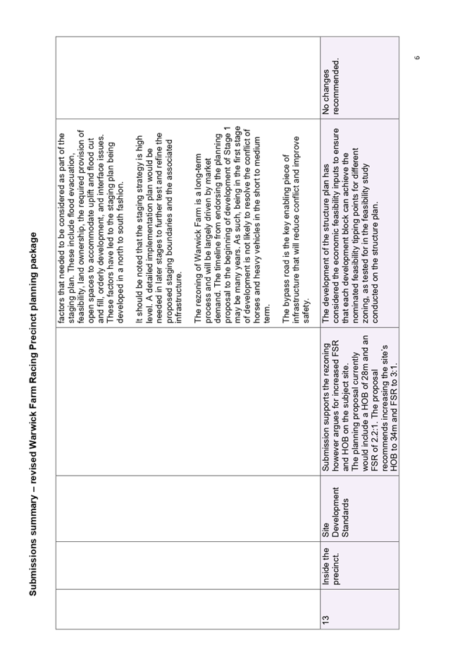
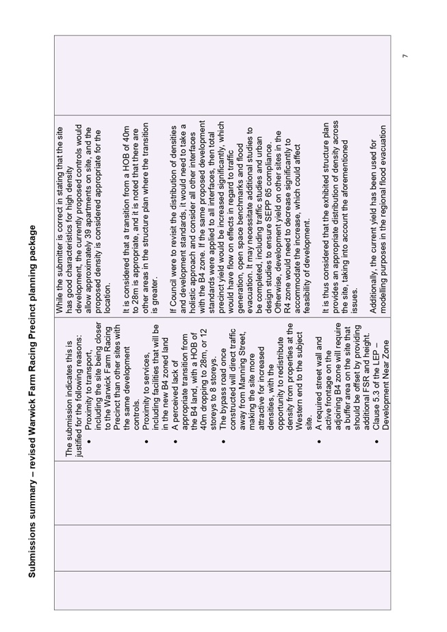
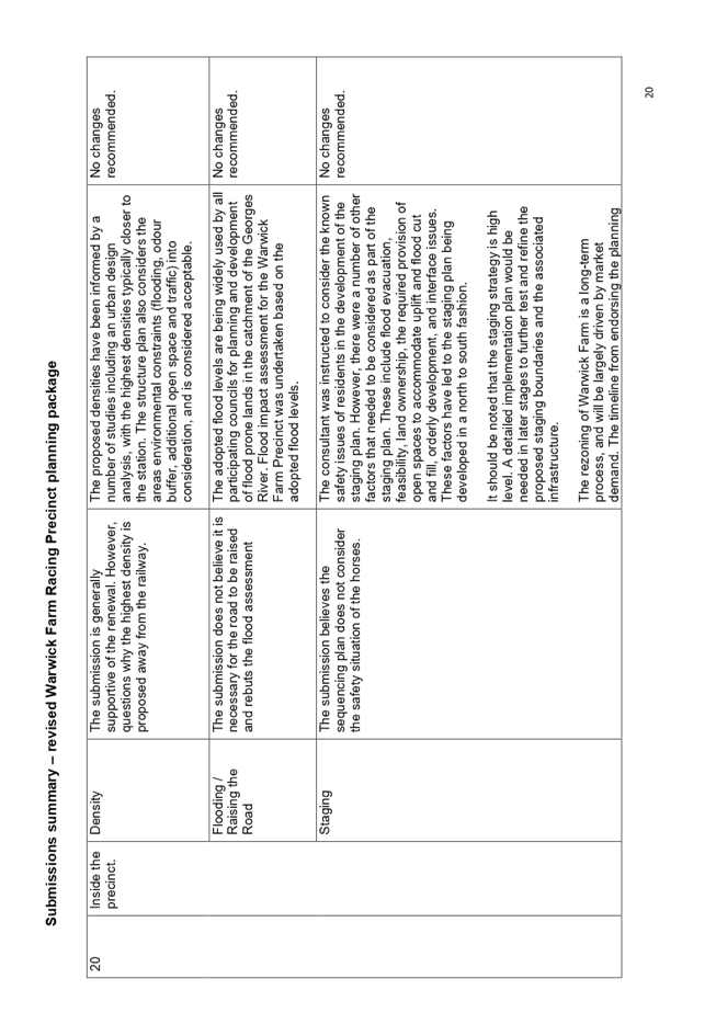
Development
standards
Of
those who supported the rezoning in principle, many indicated that development
standards should be greater on their properties to better incentivise
redevelopment, and to ensure that the design principle of having greatest
heights near the station and then tapering down is maintained.
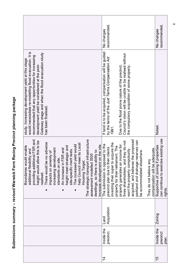
The
precinct’s current distribution of density is aligned with the urban
design principles and it is considered that the current yields are generous
enough to encourage redevelopment while remaining sensitive to site
limitations.
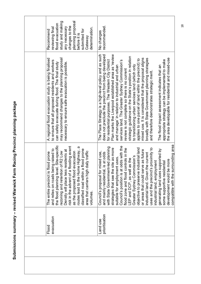
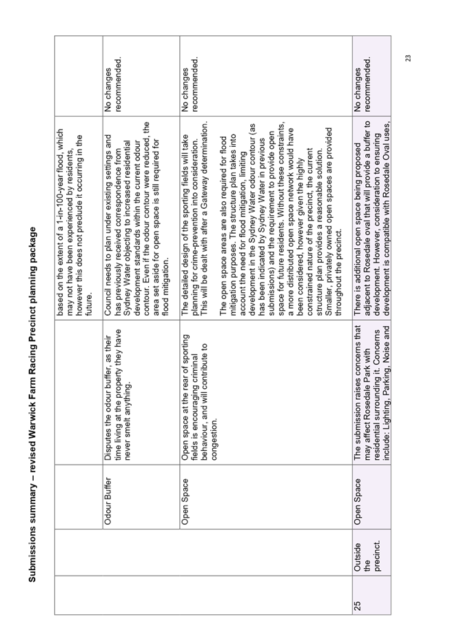
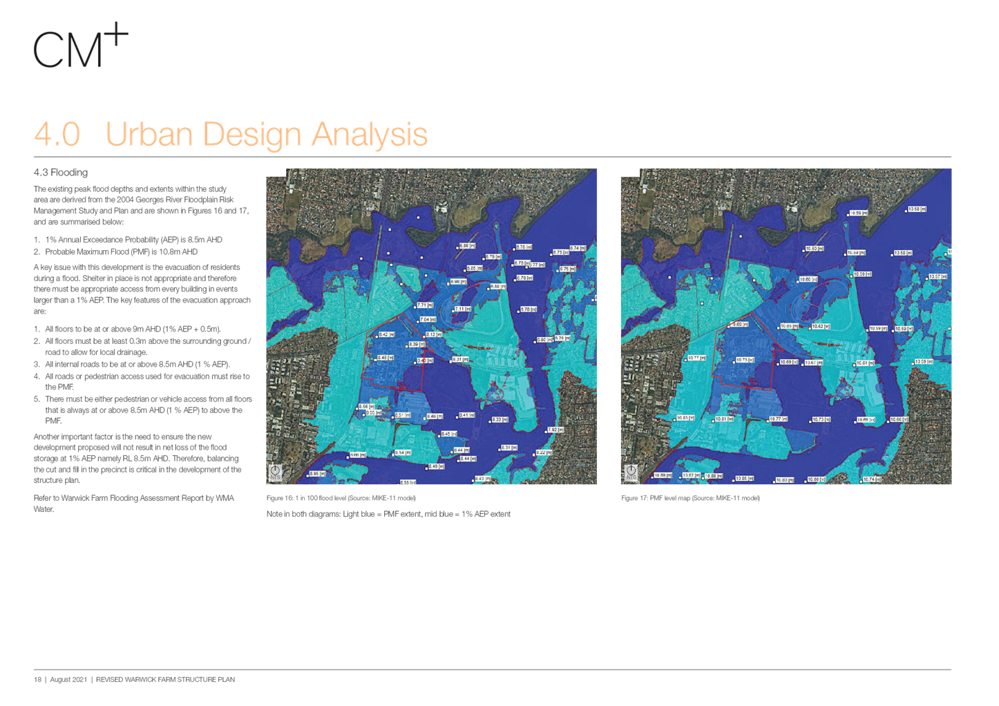
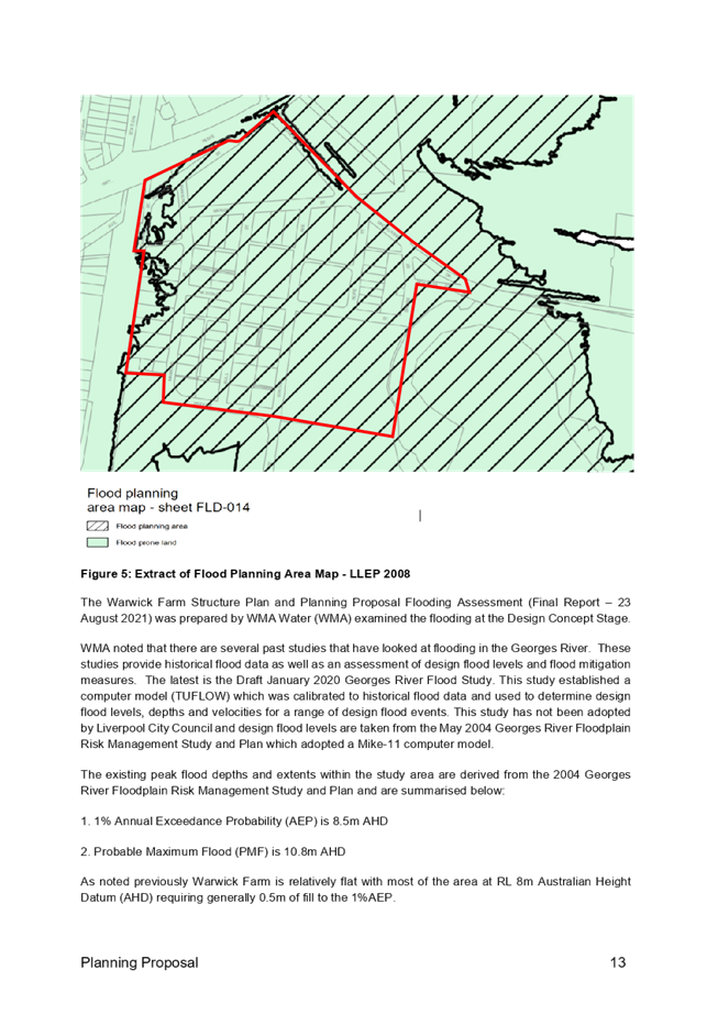
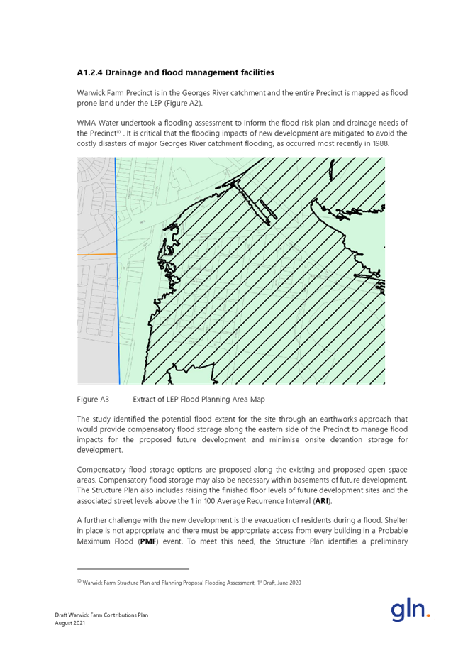
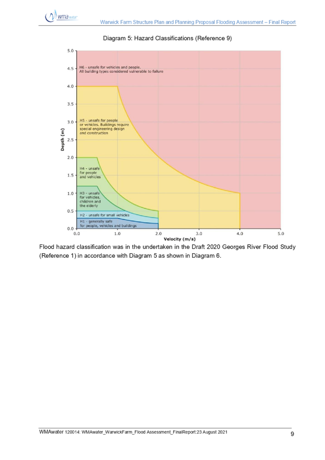
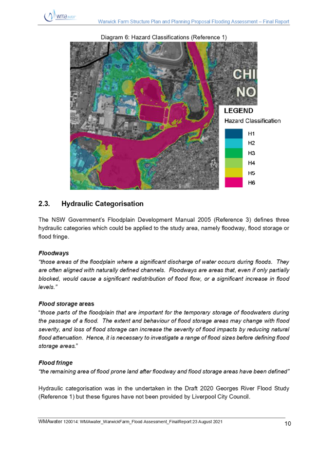
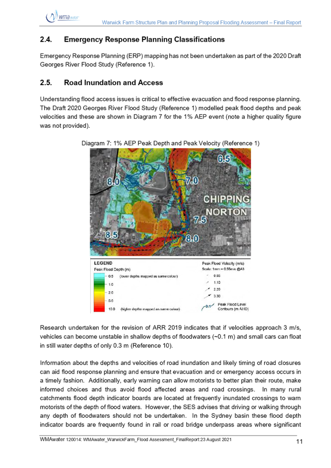
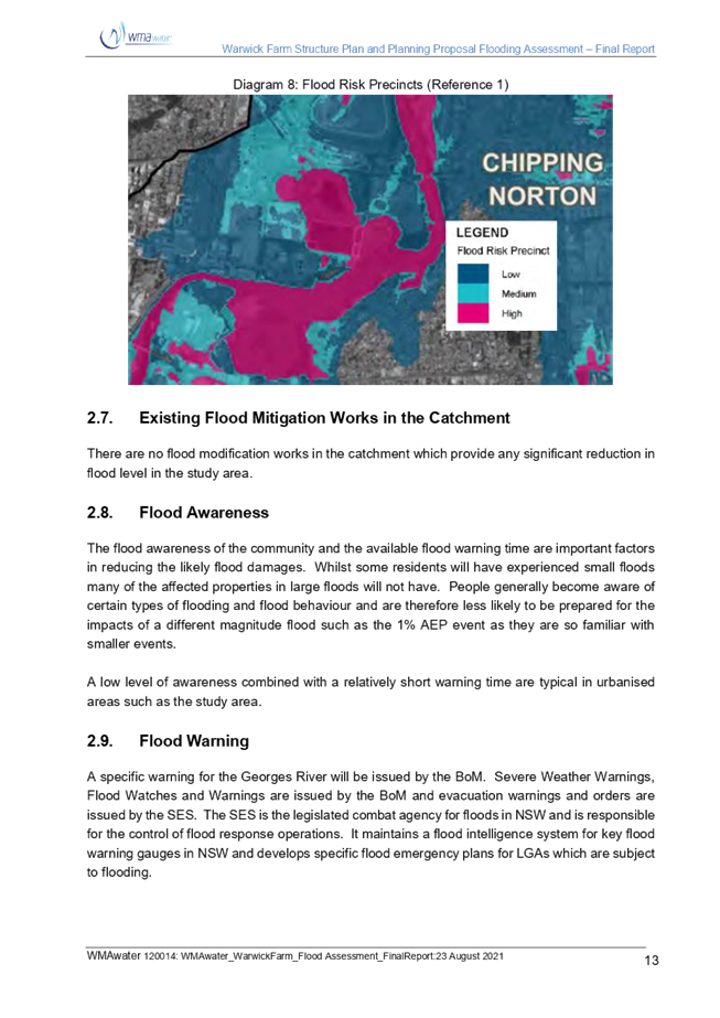
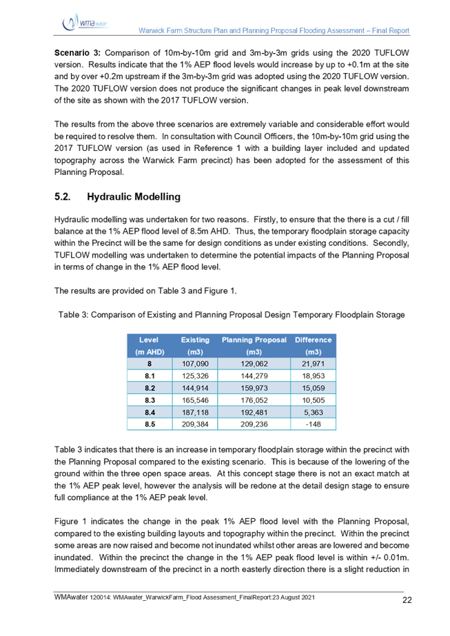
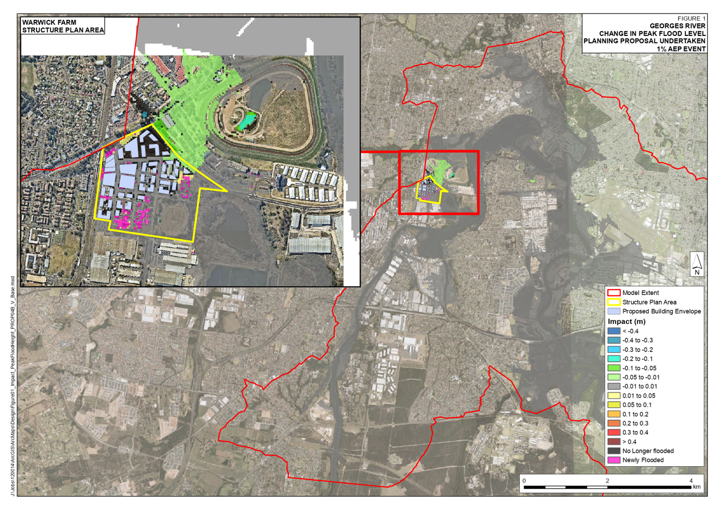
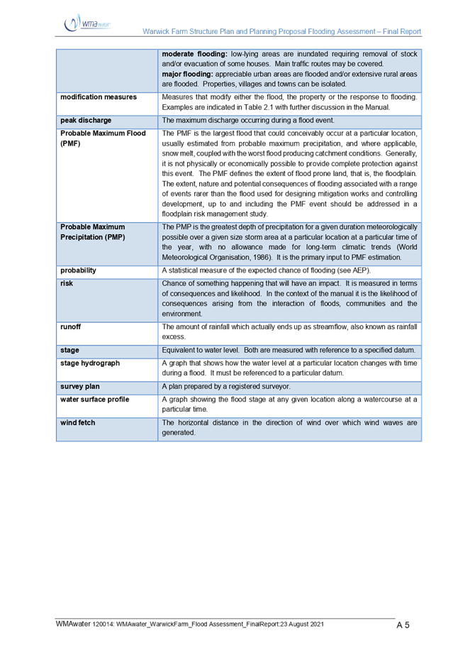
Flooding
Many
residents disagree with the findings of the detailed flood impact assessment;
however none provided any detailed flood modelling to support their submission.
Council’s
flood planning level maps indicate that the entire precinct is within the flood
planning area, and thus is subject to flood planning considerations. To enable
high density residential development in this flood prone precinct, it is
necessary for roads to be raised to the flood planning level and for new
residential development to be above the flood planning level (1:100 flood level
plus 0.5m freeboard). This is consistent with Local Planning Direction 4.3
issued by the Minister for Planning and Public Spaces.
Direction
4.3 states:
“The
objectives of this direction are:
· to ensure that development of flood prone land is consistent
with the NSW Government’s Flood Prone Land Policy and the principles of
the Floodplain Development Manual 2005; and
· to ensure that the provisions of a local environmental
plan that apply to flood prone land are commensurate with flood behaviour and
include consideration of the potential flood impacts on and off the subject
land”.
Direction
4.3 also states that a planning proposal must not contain provisions that apply
to the flood planning area which:
· permit development in floodway areas;
· permit development that will result in significant
flood impacts to other properties;
· permit development for the purposes of residential
accommodation in high hazard areas;
· permit a significant increase in the development
and/or dwelling density of that land;
· permit development for the purpose of centre-based
childcare facilities, hostels, boarding houses, group homes, hospitals,
residential care facilities, respite day care centres and seniors housing in
areas where the occupants of the development cannot effectively evacuate;
· permit development to be carried out without
development consent except for the purposes of exempt development or
agriculture. Dams, drainage canals, levees, still require development consent;
· are likely to result in a significantly increased
requirement for government spending on emergency management services, flood
mitigation and emergency response measures, which can include but are not
limited to the provision of road infrastructure, flood mitigation
infrastructure and utilities; or
· permit hazardous industries or hazardous storage
establishments where hazardous materials cannot be effectively contained during
the occurrence of a flood event.
Direction
4.3 states that a planning proposal may be inconsistent with the terms of this
direction only if the planning proposal authority can satisfy the Secretary of
the Department of Planning, Industry and Environment that:
· the planning proposal is in accordance with a
floodplain risk management study or plan adopted by the relevant Council in
accordance with the principles and guidelines of the Floodplain Development
Manual 2005, or
· where there is no council adopted floodplain risk
management study or plan, the planning proposal is consistent with the flood
study adopted by the council prepared in accordance with the principles of the
Floodplain Development Manual 2005, or
· the planning proposal is supported by a flood and risk
impact assessment accepted by the relevant planning authority and is prepared
in accordance with the principles of the Floodplain Development Manual 2005 and
consistent with the relevant planning authorities’ requirements, or
· the provisions of the planning proposal that are
inconsistent are of minor significance as determined by the relevant planning
authority.
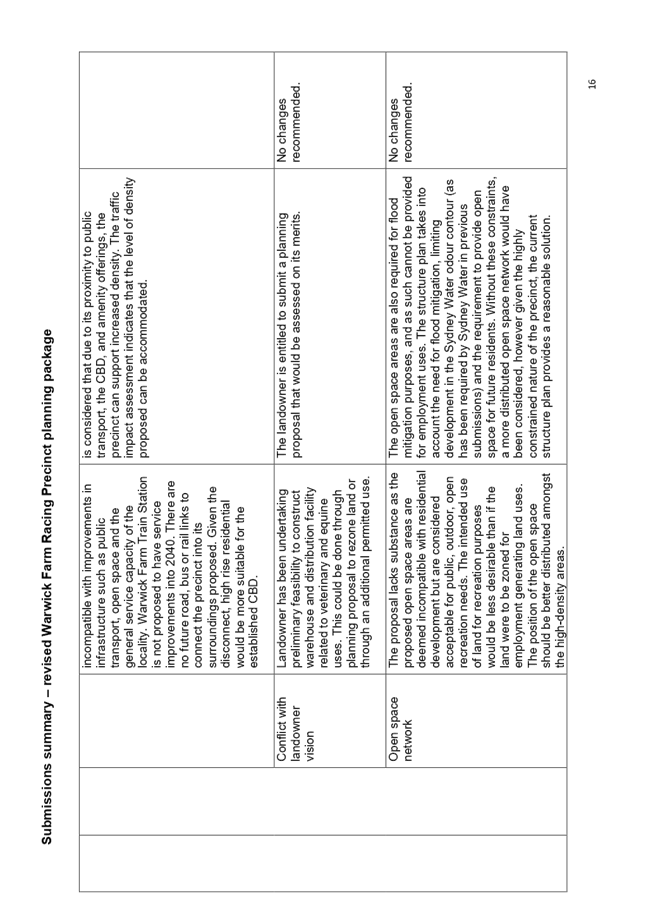
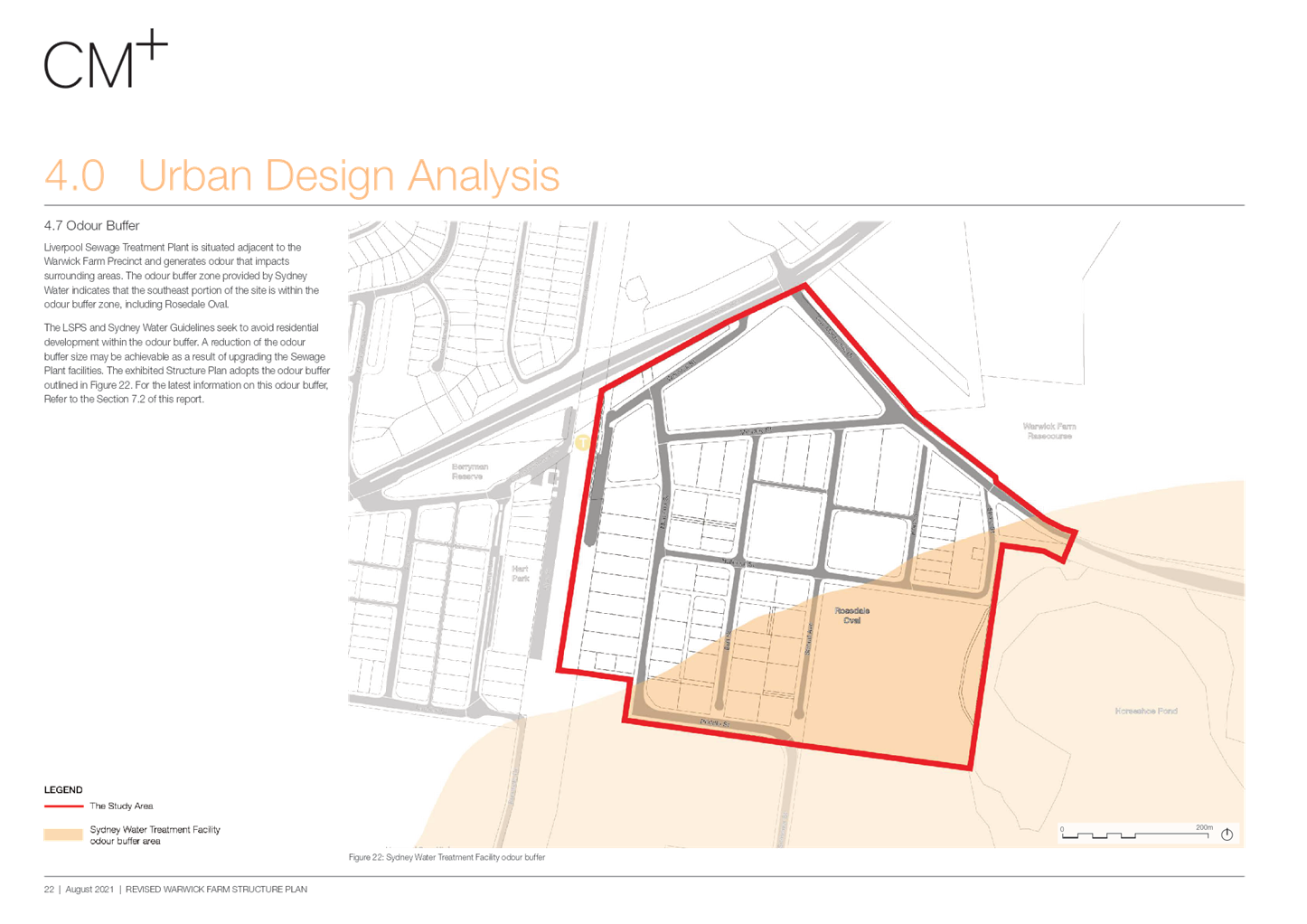
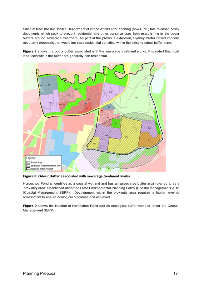
Odour
Buffer Zone
Some
submissions maintain that development should be allowed within Sydney
Water’s odour contour. As outlined to Council previously, Sydney Water
will object to any intensification of residential development in the odour
buffer area.
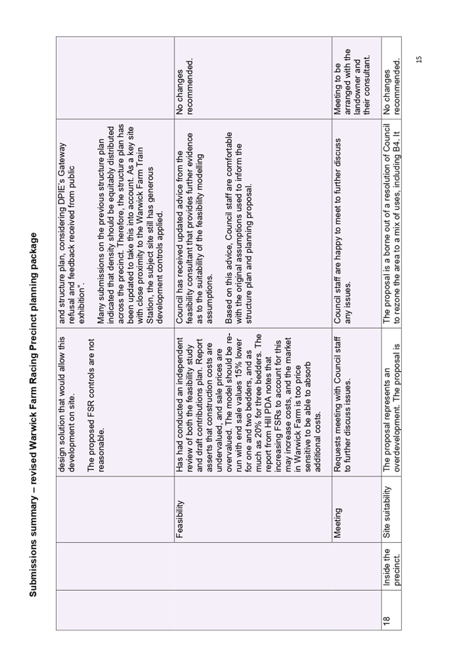
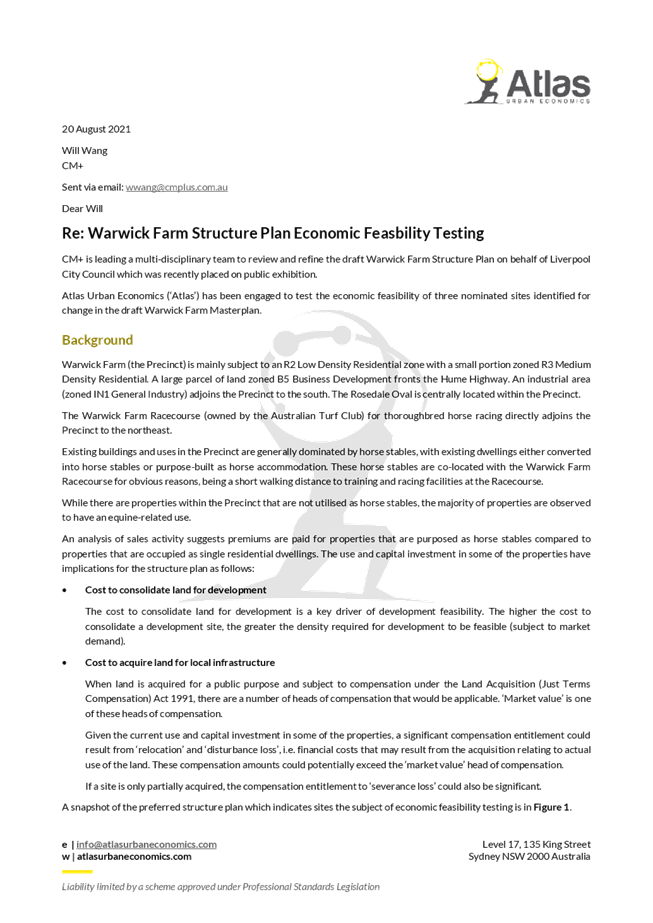
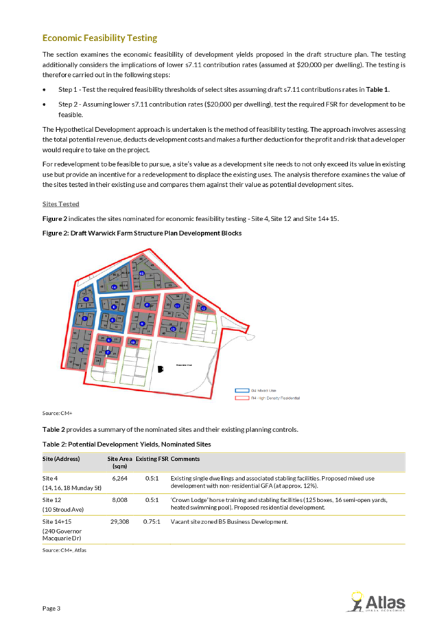
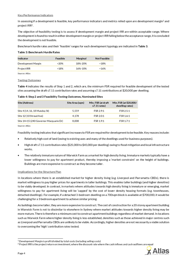
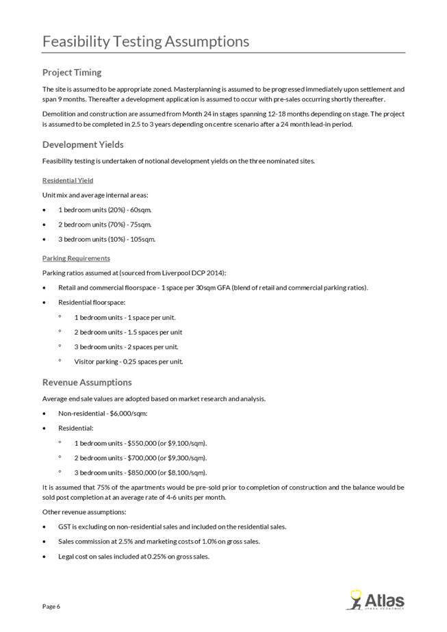
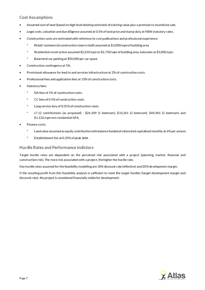
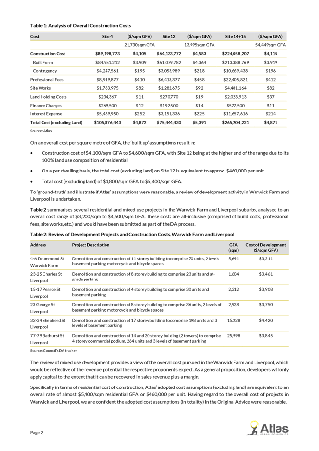
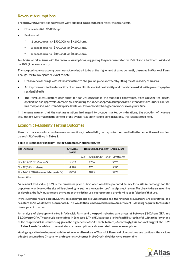
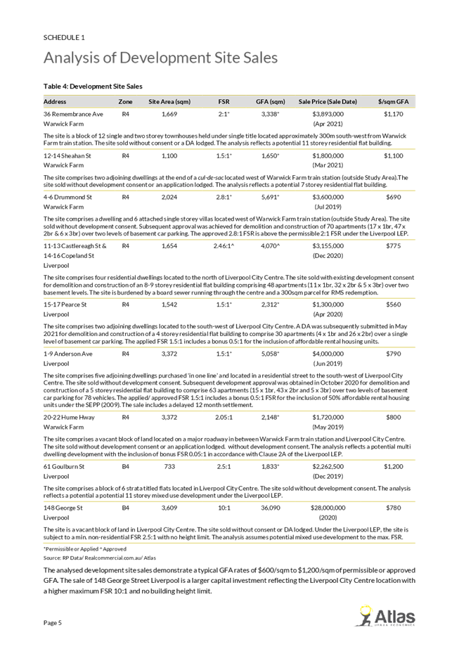
Feasibility
Two
submissions from consultants indicated that the assumptions used by
Council’s consultants for the feasibility testing, which informed the
floor space ratio (FSR) controls, used assumptions that underestimated the cost
of development, and overestimated the price of apartments, and contained other
assumptions that were not industry norms. These submissions were referred to
Council’s consultant who has reviewed the submissions and provided a
detailed response (Attachment 10) that justifies the original assumptions used.
It is therefore considered that the original assumptions are sound.
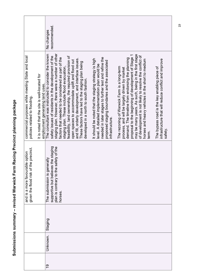
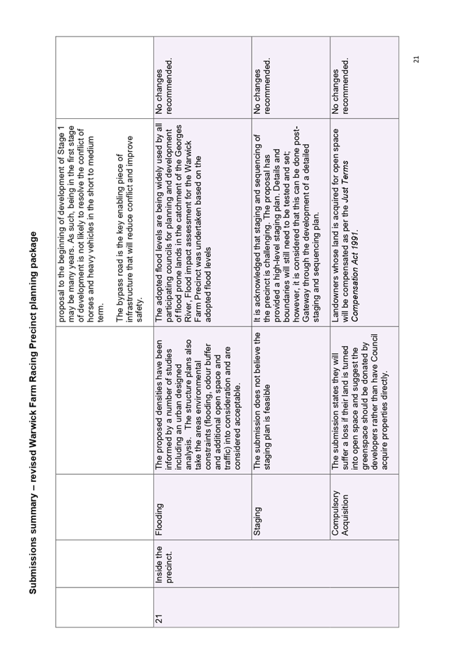
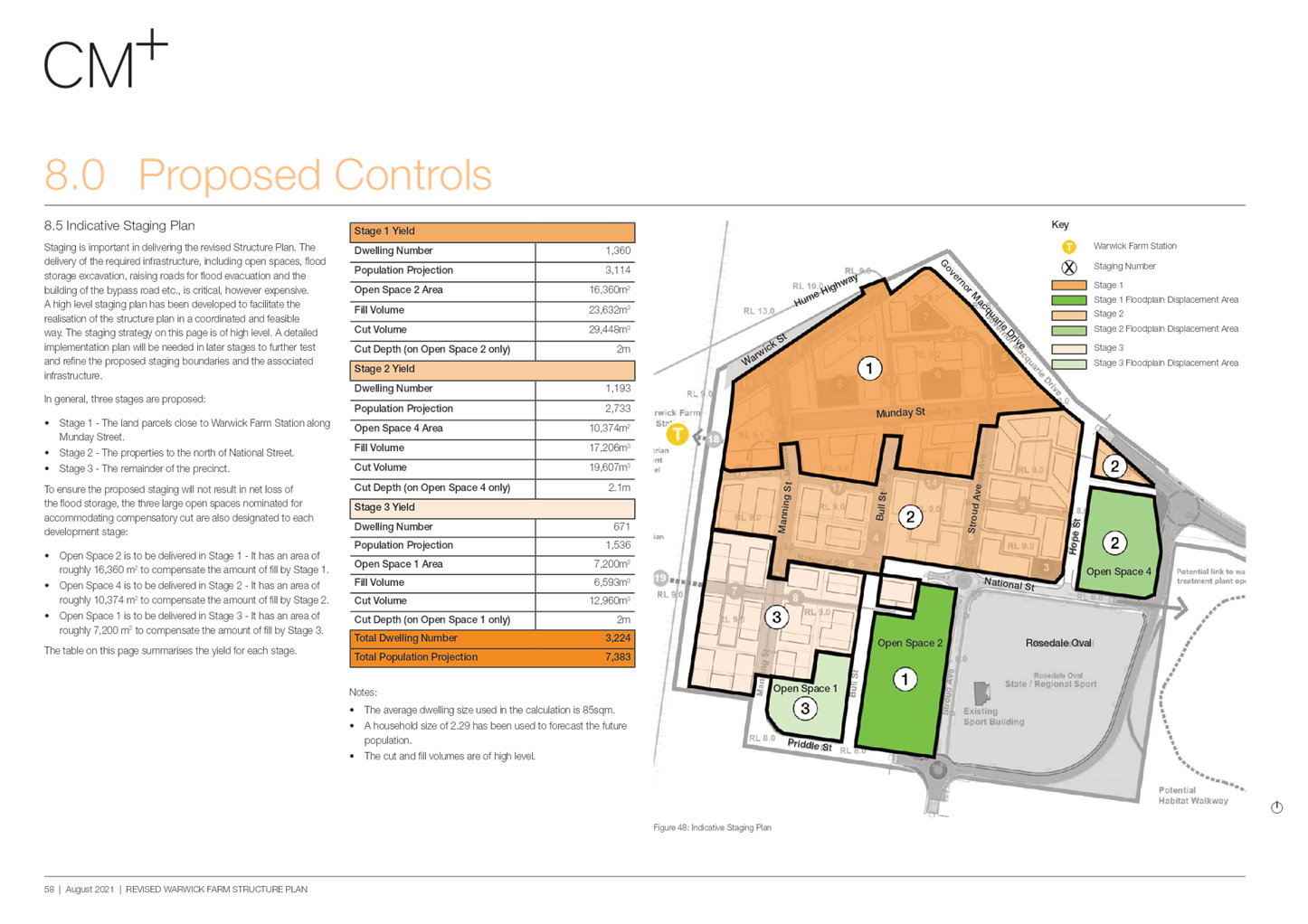
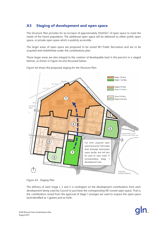
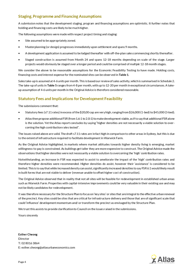
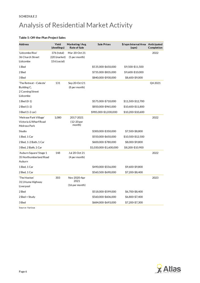
Staging
and Safety
Some
submissions are from properties that are not included in Stage 1 of the
indicative staging plan and have indicated that they do not agree with how the
stages have been selected. Key to this concern is that the initial reason for
rezone the precinct, which is to allow horse trainers to move off-site due to
increasing conflict between industrial vehicles and horses, particularly along
Manning Street, is not adequately considered by the staging plan.
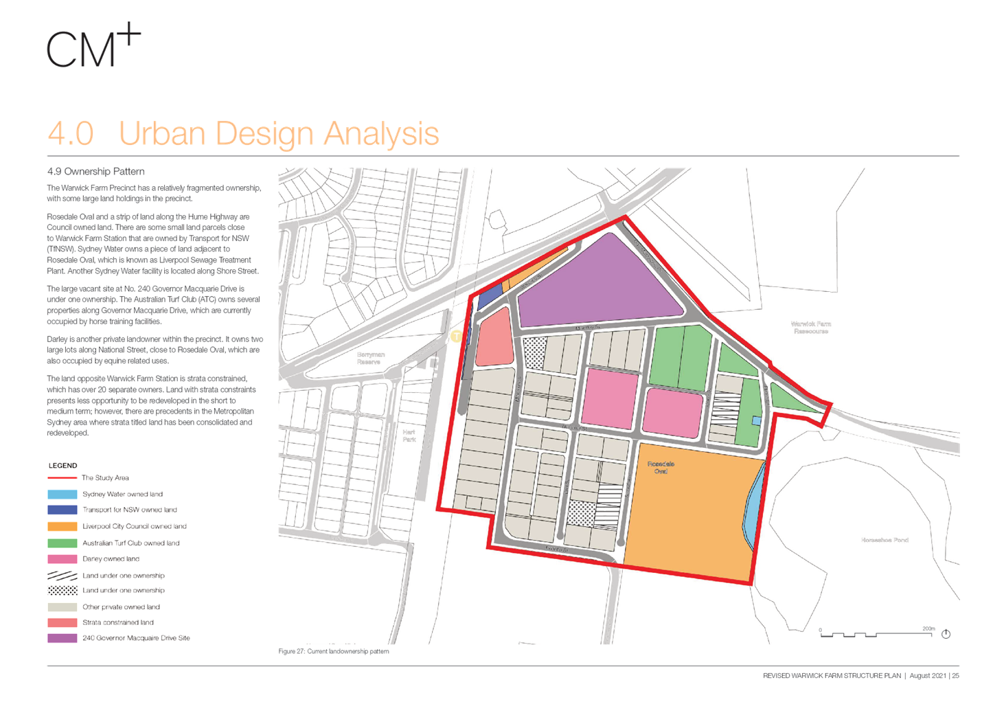
The
primary need for a staging plan is due to the fragmented land ownership in the
precinct and the need to address flooding constraints and flood evacuation
requirements to meet Local Planning Directions for development on flood prone
land. As identified above, the precinct is flood prone, and any rezoning of the
precinct must demonstrate that the precinct can be developed above the flood
planning level and that people can safety evacuate the precinct in times of
flood.
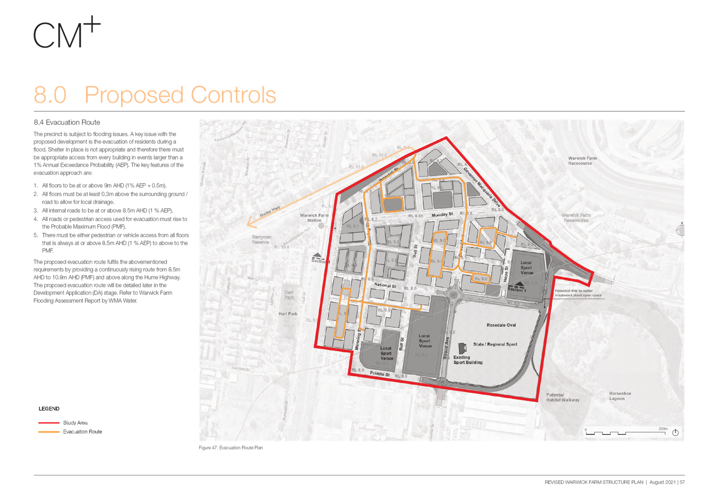
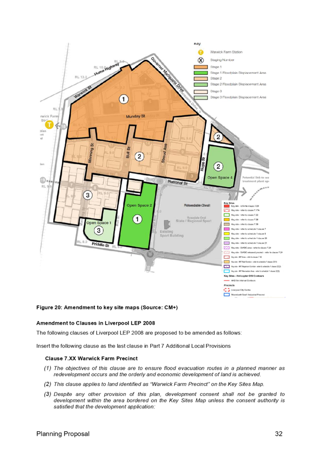
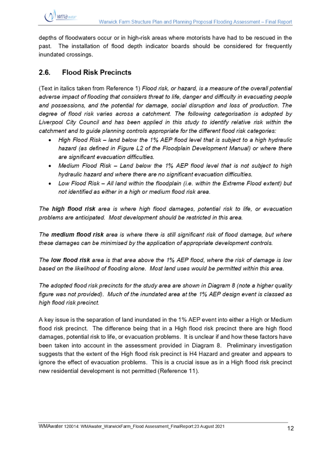
Considering
the Hume Highway (overbridge) is the high point, development in the precinct
must occur from north to south to ensure a continually rising evacuation path
exists from the southern parts of the precinct to the Hume Highway and onto the
overbridge.
The
staging plan is indicative only. Should a future developer provide an alternate
staging plan at the DA stage that achieves the stated objective to facilitate
evacuation of the precinct in a flood event, this will be considered by
Council. The future redevelopment of this precinct will likely be a long-term
process and will be largely driven by market demand. The timeline from
endorsing the planning proposal to the beginning of development may be several
years. The bypass road is the key enabling piece of infrastructure that will
reduce heavy vehicle conflict and improve safety.
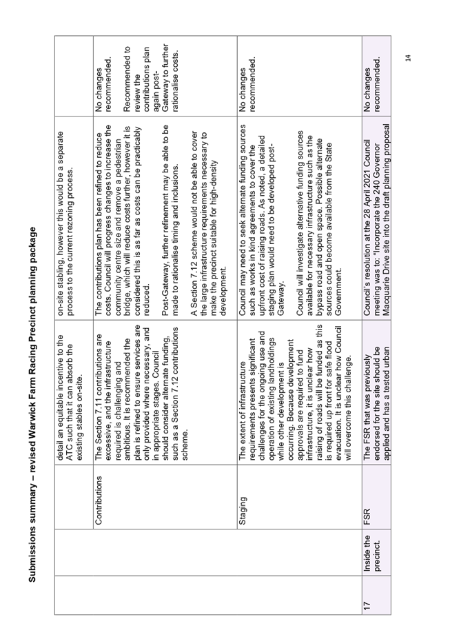
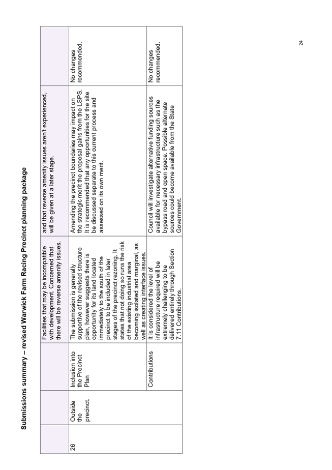
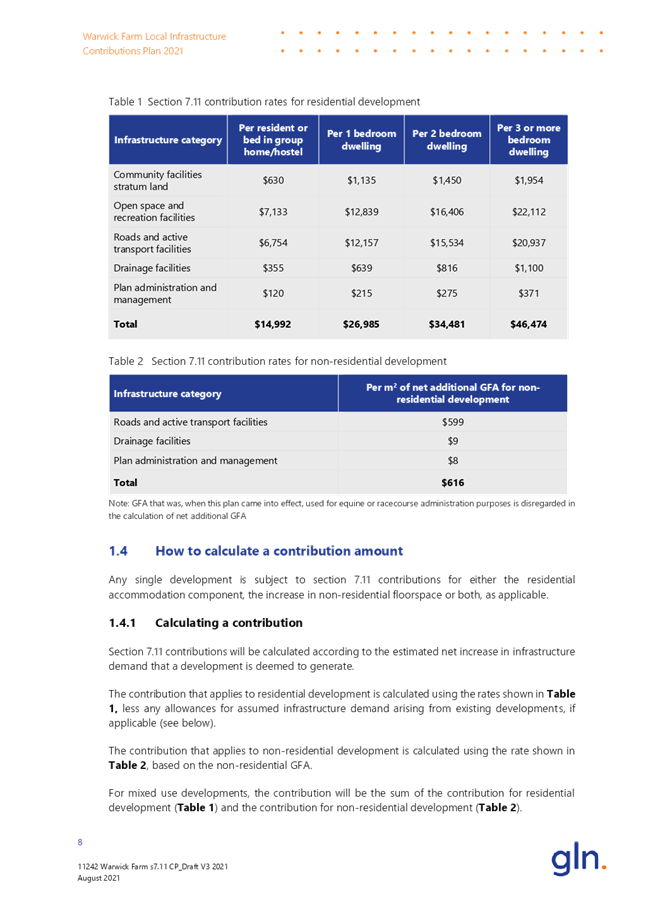
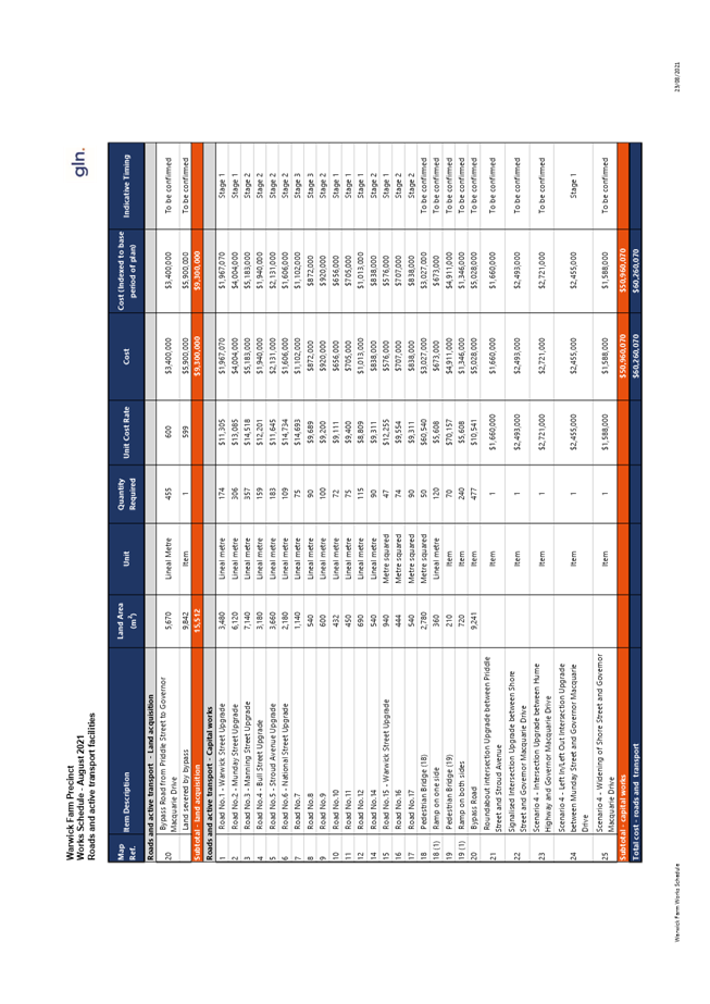
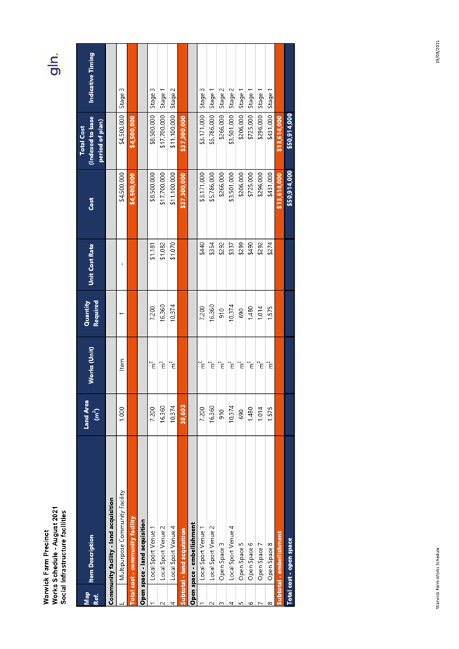
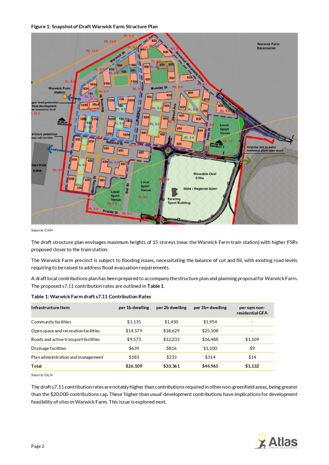
Contributions
Many
submissions indicated that the high contribution rates would make redevelopment
challenging and that Council should investigate other ways to reduce the
contribution rates. It is acknowledged that the contribution rates are
relatively high, compared to other areas, however this reflects the constrained
nature of the precinct, and the level of infrastructure needed to support
growth in this area, without unfairly overburdening other ratepayers in
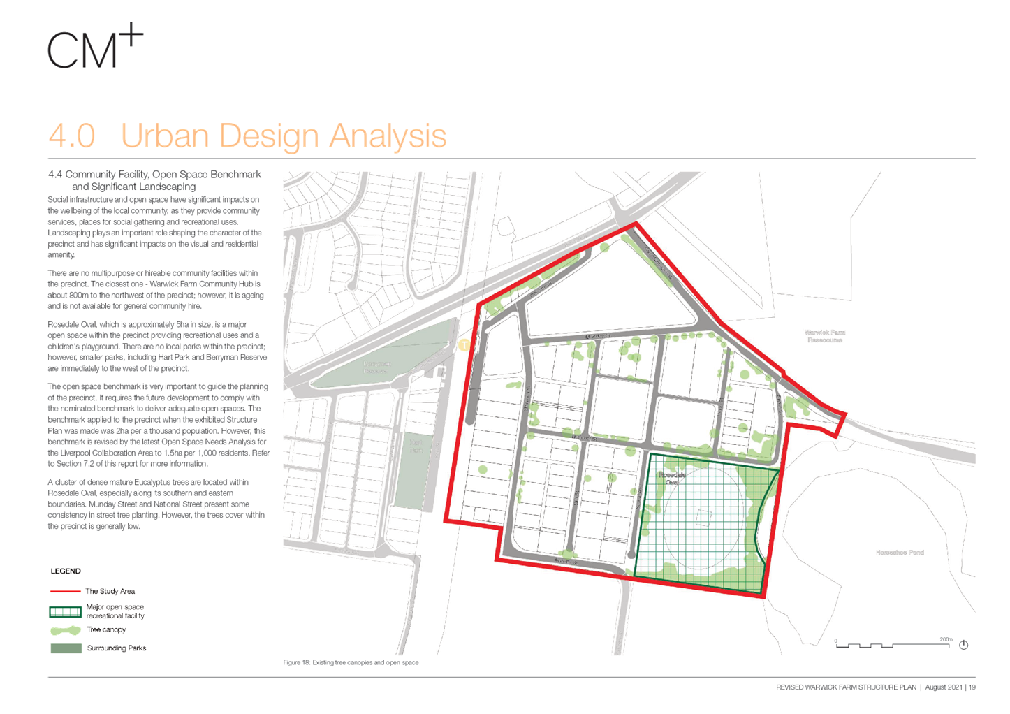
Liverpool. Other sources of funding for key infrastructure such as open space
and the bypass road will still be investigated, and amendments made to the
contributions plan if appropriate.
Major landowner submissions
Council received detailed submissions from three major
landholders in the Warwick Farm Racing Precinct. These included:
· Australian Turf Club;
· Godolphin; and
· Warwick Farm Central Pty Ltd (240 Governor
Macquarie Drive).
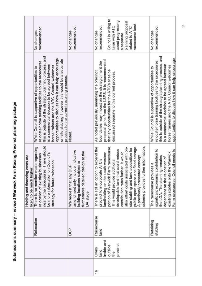
Australian Turf Club submission
The
Australian Turf Club (ATC) is the owner of the Warwick Farm racecourse and
three additional lots of land within the Warwick Farm racing precinct. The ATC
made an extensive submission, reiterating their former request that ATC land
outside the current precinct be considered as part of the current planning
work, as they believe doing so would reduce contributions rates and offset the
costs associated with on-site stabling, and land acquisition needed for public
open space and flood storage.
It
is considered that amending the precinct boundary would be inconsistent with
Council’s previous resolutions, which focus this strategic planning on
the horse training precinct. There is also the risk that the proposals
strategic merit may be undermined as Council’s Local Strategic Planning
Statement (LSPS) does not envisage the precinct expanding to the racecourse
site.
ATC
would like further clarity regarding incentives for absorbing stabling on-site.
As previously mentioned, any planning changes to ATC land outside the precinct
can be pursued separately and will need to address the LSPS. While Council is
supportive of opportunities to relocate horse training to the racecourse,
ultimately this is a commercial decision for the ATC and horse trainers.
Council will continue to engage with ATC as needed to understand their
requirements and facilitate conversations with current horse trainers.
ATC
also indicated that the Contributions Scheme remains too expensive. It is
acknowledged that the contribution rates are relatively high, compared to other
areas, however this reflects the constrained nature of the precinct, and the
level of infrastructure needed to support growth in this area, without unfairly
burdened other ratepayers in Liverpool. Other sources of funding for key
infrastructure such as open space and the bypass road will still be
investigated, and amendments made to the contributions plan if appropriate.
ATC
also stated that the staging and sequencing of development would be
challenging, as roads would need to be raised prior to development
contributions being received. Council may need to pool contributions or seek
alternative funding sources to cover upfront costs or enter works in kind
agreements with developers to enable future development.
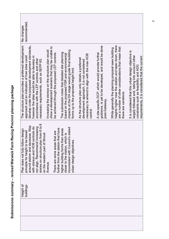
Godolphin
submission
Godolphin
owns two large blocks within the precinct. Their submission indicated that the
urban design principles of height transitioning down from the Warwick Farm
station was not followed precisely and requested that the number of storeys on
the structure plan be revised to match the height of building controls
proposed. It is noted that the structure
plan provides a preferred development approach and an indication of how sites
could develop under the proposed development standards, however the sites would
be able to develop in accordance with the LEP controls and other necessary
requirements, such as SEPP 65, and therefore no changes are considered
necessary.
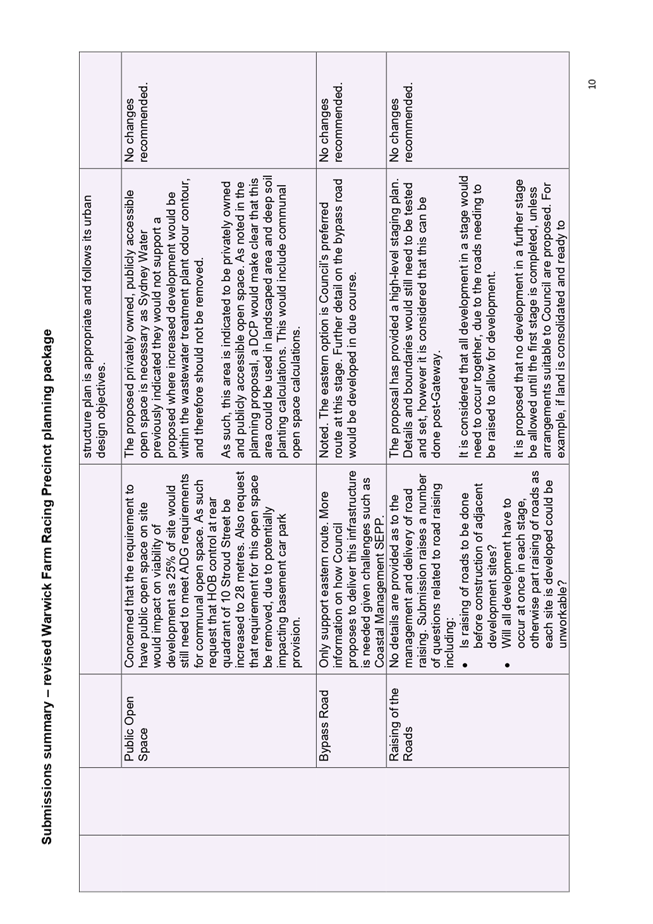
They
indicated concern regarding the structure plan marking an area of privately
owned publicly accessible open space on site, that would not be zoned for
public recreation. It is proposed to keep this area unchanged, as it is
burdened by the odour contour, and having increased development potential in
this area may lead to Sydney Water not supporting the precinct redevelopment.
The area can also be used in landscaped area and deep soil planting
calculations so should have limited impact on the development potential of the
site.
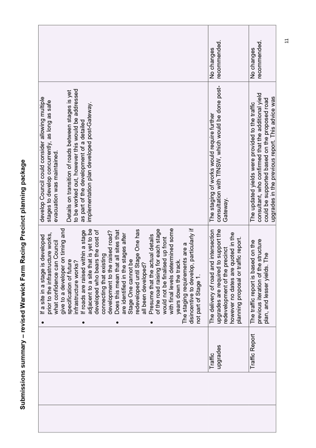
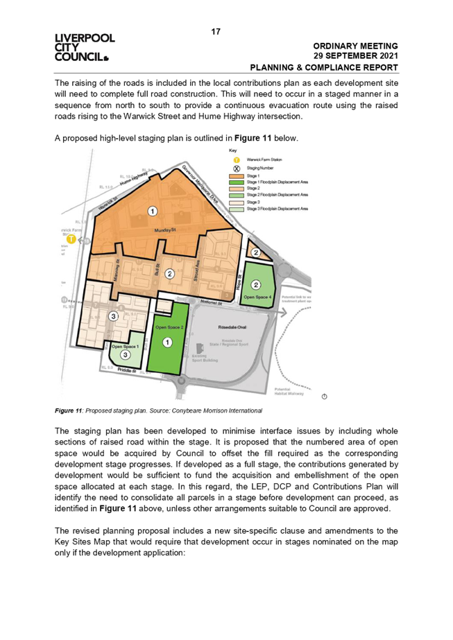
Further detail on raising of the roads was requested,
how this would be practically accomplished, and whether development could
proceed out of sequence. Council has provided a high-level staging plan to address this issue. Details and
boundaries would still need to be tested and set, however it is considered that
this can be done post-Gateway in a detailed plan. It is considered that all
development in a stage would need to occur together, due to the roads needing
to be raised to allow for development. It is proposed that no development in a
further stage be allowed until the first stage is completed unless arrangements
suitable to Council are proposed as part of future DAs.
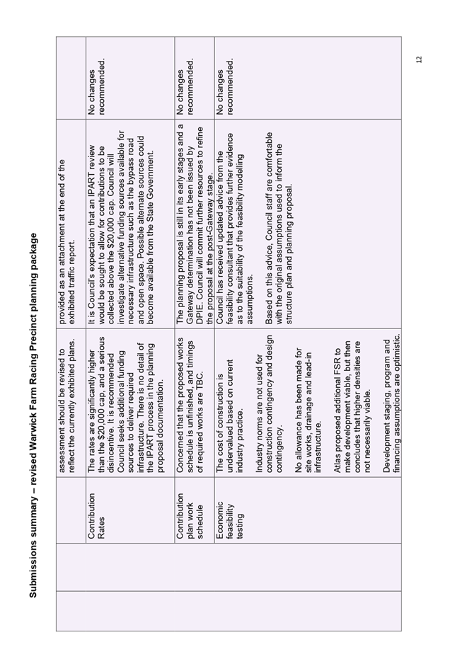
Godolphin also raised issues with the contributions
rates and recommended that Council seek other funding sources to reduce the
contributions rates. It is
acknowledged that the contribution rates are relatively high, compared to other
areas, however this reflects the constrained nature of the precinct, and the
level of infrastructure needed to support growth in this area, without unfairly
burdened other ratepayers in Liverpool. Other sources of funding for key
infrastructure such as open space and the bypass road will still be
investigated, and amendments made to the contributions plan if appropriate.
Finally, Godolphin raised issues with the exhibited
economic feasibility modelling, indicating that the cost of construction was
undervalued based on current industry best practice, that industry norms
weren’t used in assumptions, requiring amendments and potentially a
review of development standards. The consultant engaged to conduct the economic
feasibility modelling has provided advice responding to concerns raised during
public exhibition (Attachment 10). Based on this advice, it is
considered that the original assumptions used in the economic feasibility
testing are sound.
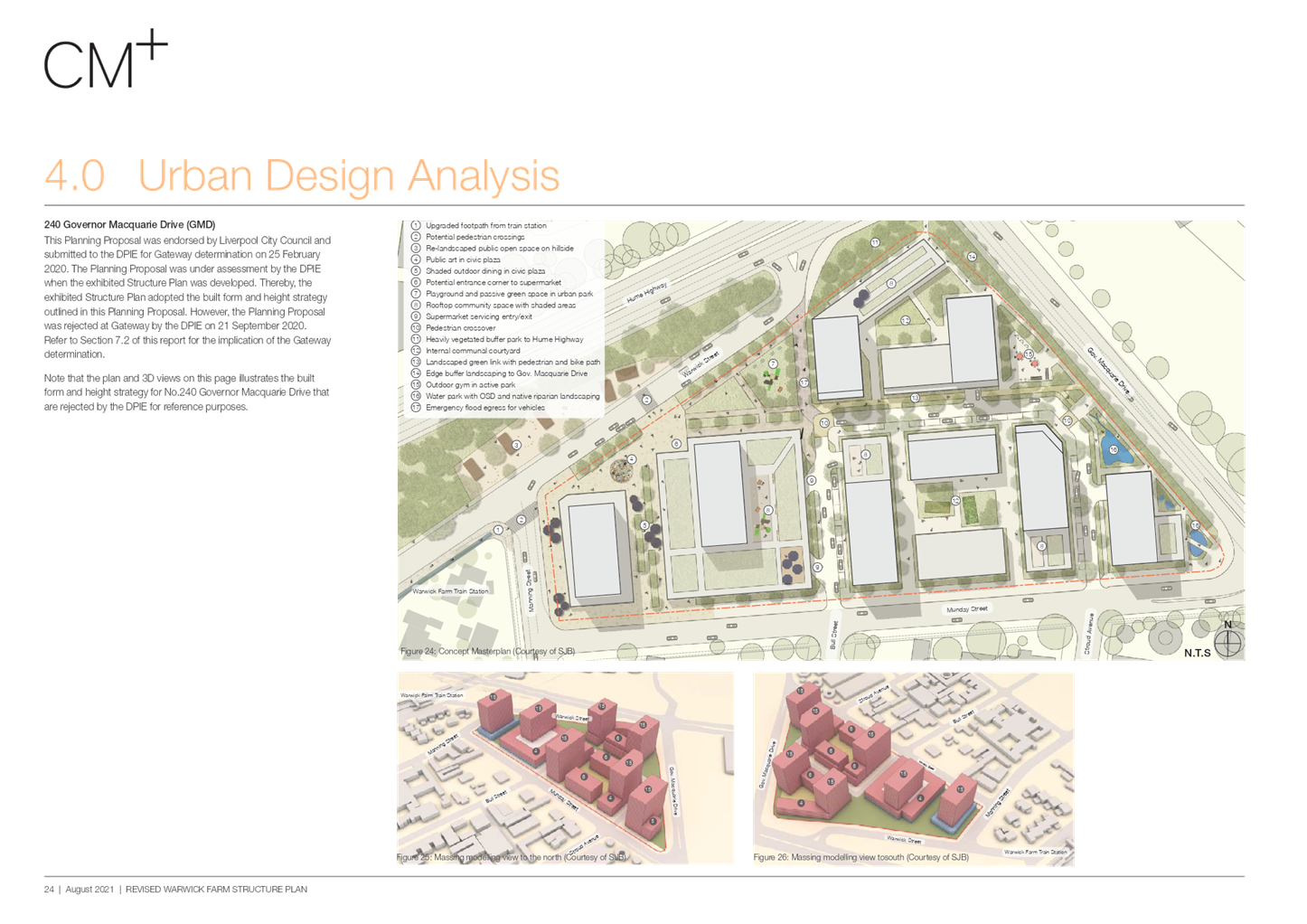
Warwick
Farm Central Pty Ltd submission
Warwick Farm Central Pty Ltd, owners of the 240
Governor Macquarie Drive site, state that the FSR previously endorsed by
Council in a separate planning proposal should be applied to the structure plan
for the precinct. Council’s resolution at the 28 April 2021 Council
meeting was to: “Incorporate the 240 Governor Macquarie Drive site
into the draft planning proposal and structure plan, considering DPIE’s
Gateway refusal and feedback received from public exhibition”. Many
submissions on the previous structure plan indicated that density should be
more equitably distributed across the precinct. Therefore, the structure plan
has been updated to take this into account.
The submission also raised concerns with the
feasibility testing assumptions, including that end sale prices have been
overvalued, providing a consultant report to outline this point; and that
construction costs had been undervalued, providing another report to outline
this point.
As mentioned previously, the consultant engaged to
conduct the economic feasibility modelling has provided advice responding to
concerns raised during public exhibition (Attachment 10). Based on this advice,
it is considered that the original assumptions used in the economic feasibility
testing are sound.
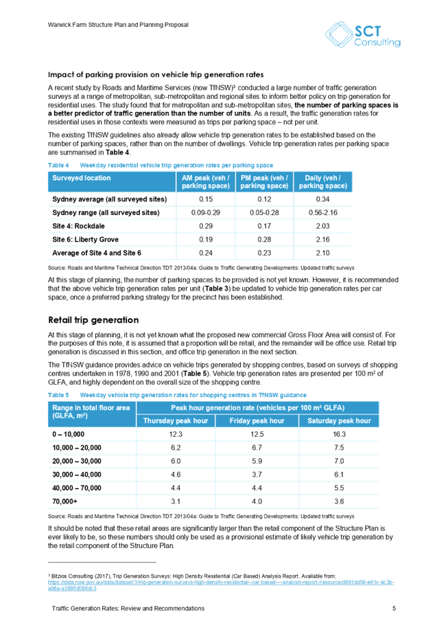
Facebook Feedback
A Facebook post was published to publicize the
proposed planning package and obtain feedback from the wider Liverpool
community on 21 October 2021.
A screenshot is provided at Figure 4 below.
The
post was shared 27 times, and received 346 comments and 143 reactions,
including 70 ‘likes’ and 60 ‘angry faces’. The link to
the public exhibition page was clicked 291 times, and the post’s reach
was 16,700 users.
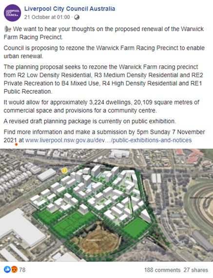
Figure 4 - A Facebook post
on the proposed planning package
Most
comments were negative in relation to the proposed planning package, and the
most expressed sentiments were regarding a perception of overdevelopment in
Liverpool, and the proposal exacerbating traffic congestion, which many commenters
saw as a current unresolved issue.
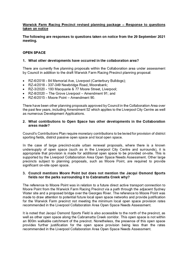
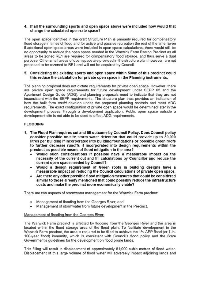
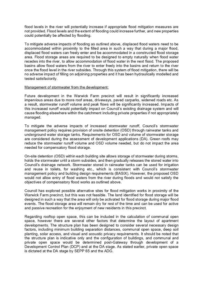
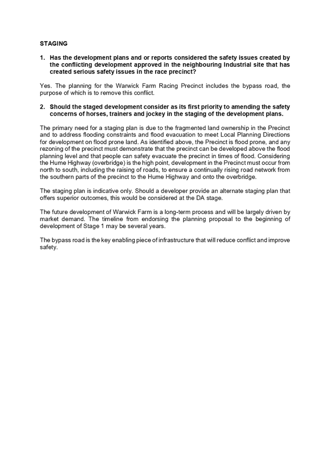
Questions
taken on notice
A series of questions were taken on notice at the 29
September 2021 Council meeting related to open space, flooding, and staging,
with answers to be provided as part of this report to Council. Answers to these
questions are provided in Attachment 3.
Completion of flood evacuation study
Recent changes in DPIE’s planning proposal
assessment processes mean that more information is now being required prior to
planning proposals being lodged with DPIE seeking a Gateway determination.
Planning proposals within the Liverpool Collaboration Area and Moorebank East
have been returned from Gateway assessment, with DPIE stating that planning
proposals should only be resubmitted “once the findings of
Council’s Regional Flood Evacuation Study can inform the proposal”.
Based on previous and ongoing discussions with DPIE, a
proposal sent to Gateway prior to this study being completed will not be
accepted.
Council is finalising this study, with a draft
discussion paper due at the end of November 2021 to enable further detailed
discussions with SES, DPIE and the Planning Delivery Unit (PDU). Council will
continue to progress the finalisation of this study, with the assistance of the
PDU and DPIE.
Next Steps
It
is recommended that Council supports in principle the revised planning package as exhibited,
and upon finalisation of the Regional Flood Evacuation Study, delegates authority to the CEO to make any minor amendments to
the planning package as may be required and forwards the planning proposal to
the Department of Planning, Industry and Environment (DPIE) seeking a Gateway
determination.
|
Economic
|
Deliver and maintain a range of transport related infrastructure such
as footpaths, bus shelters and bikeways.
Deliver a high quality local road system including provision and
maintenance of infrastructure and management of traffic issues.
Facilitate economic development.
|
|
Environment
|
Promote an integrated and user friendly public transport service.
|
Social
|
Regulate for a mix of housing types that responds to different
population groups such as young families and older people.
|
Civic
Leadership
|
There are no civic leadership and governance
considerations.
|
|
Legislative
|
Environmental Planning and Assessment Act 1979
|
|
Risk
|
The risk is deemed to be Low at this
early stage in the plan making process, given the analysis completed in
relation to flooding, traffic and open space.
The risk in relation to the
recommendations of the report is considered within Council’s risk
appetite.
|
1. Submissions
Summary
2. Submissions
Summary
- Confidential
3. Responses
to questions taken on notice
4. Draft
Structure Plan
5. Draft
Planning Proposal
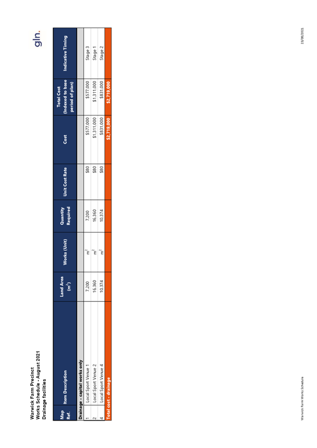
6. Draft
Contributions Plan
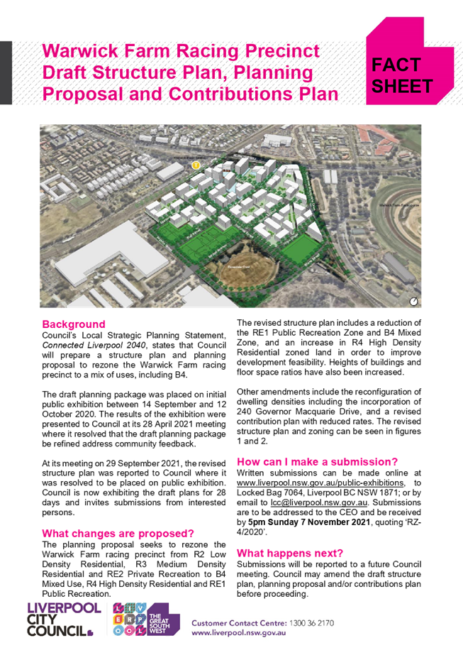
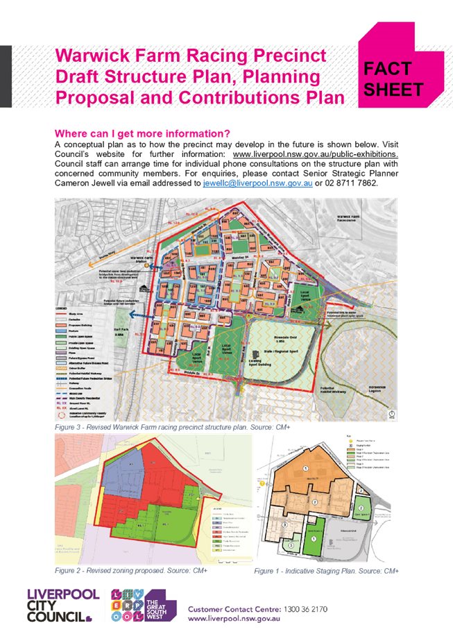
7. Summary
Fact Sheet
8. 29
September 2021 Council Report
9. Flood
Assessment Report
10. Economic
Feasibility Testing
11. Traffic
Impact Assessment
12. Fact
Sheet on Property Acquisition